📰 Trending Topics
Google News - Trending
Trending stories for July 7, 2026 - FOX 5 Atlanta
2026-07-07 17:55
Google News - Technology
Google announces Pixel 11 launch event in August - The Verge
2026-07-07 17:22
- Google announces Pixel 11 launch event in August The Verge
- Google Pixel 11 Leak Hints at Higher Prices, New Colors and More Storage CNET
- Google announces August 12 event for Pixel 11 and Pixel Watch 5 9to5Google
- Google's Pixel 11 features higher starting price, removal of low storage model: report Seeking Alpha
- Google's Next Pixel Event Is On August 12 Engadget
Siri AI can pull info from third-party apps in the latest developer beta - 9to5Mac
2026-07-07 12:13
- Siri AI can pull info from third-party apps in the latest developer beta 9to5Mac
- Here’s what’s new with iOS 27 beta 3 9to5Mac
- 12 New Things Your iPhone Can Do in iOS 27 MacRumors
- New in iOS 27 beta 3: Siri AI voice customization options AppleInsider
- You can now customize Siri’s pace and expressivity in the latest iOS 27 beta TechCrunch
Android 17 July update rolling out with four Pixel fixes - 9to5Google
2026-07-07 18:33
- Android 17 July update rolling out with four Pixel fixes 9to5Google
- 2026 July Pixel Update Available for Your Pixel Phone Droid Life
- Android 17 QPR1 Beta 6 just dropped these critical bug fixes for Google Pixel PhoneArena
- How to install the latest Android 17 Beta on Google Pixel 9to5Google
- Google's July 2026 update is here for your Pixel phone Android Authority
Nothing's New $99 Ear 3A Buds Have a Feature I Haven't Seen Anywhere Else - CNET
2026-07-07 10:30
- Nothing's New $99 Ear 3A Buds Have a Feature I Haven't Seen Anywhere Else CNET
- Nothing’s new earbuds can record calls and what you’re listening to The Verge
- Nothing Announces Ear (3a) Sub-$100 ANC Earbuds Engadget
- Nothing’s Ear 3a Wireless Earbuds Can Take ‘Audio Snapshots’ Gizmodo
- New Nothing Ear (3a) earbuds can record meetings and clip audio like snapping a screenshot Android Police
iPhone 18 Pro Could Be Noticeably Thicker Than iPhone 17 Pro - MacRumors
2026-07-07 14:56
- iPhone 18 Pro Could Be Noticeably Thicker Than iPhone 17 Pro MacRumors
- Apple iPhone 18 Pro supplier list, parts and photos exposed in Tata data leak Reuters
- Apple iPhone 18 Pro leaks are about to get a lot more intense Mashable
- Weibo leaker says iPhone 18 Pro thickness will be ‘surprising’ 9to5Mac
- Apple leaks have sucked all the fun out of iPhone season Macworld
NASA - Breaking News
NASA Transfers ‘Hundred Acre Wood’ to Patuxent Research Refuge
2026-07-07 18:00
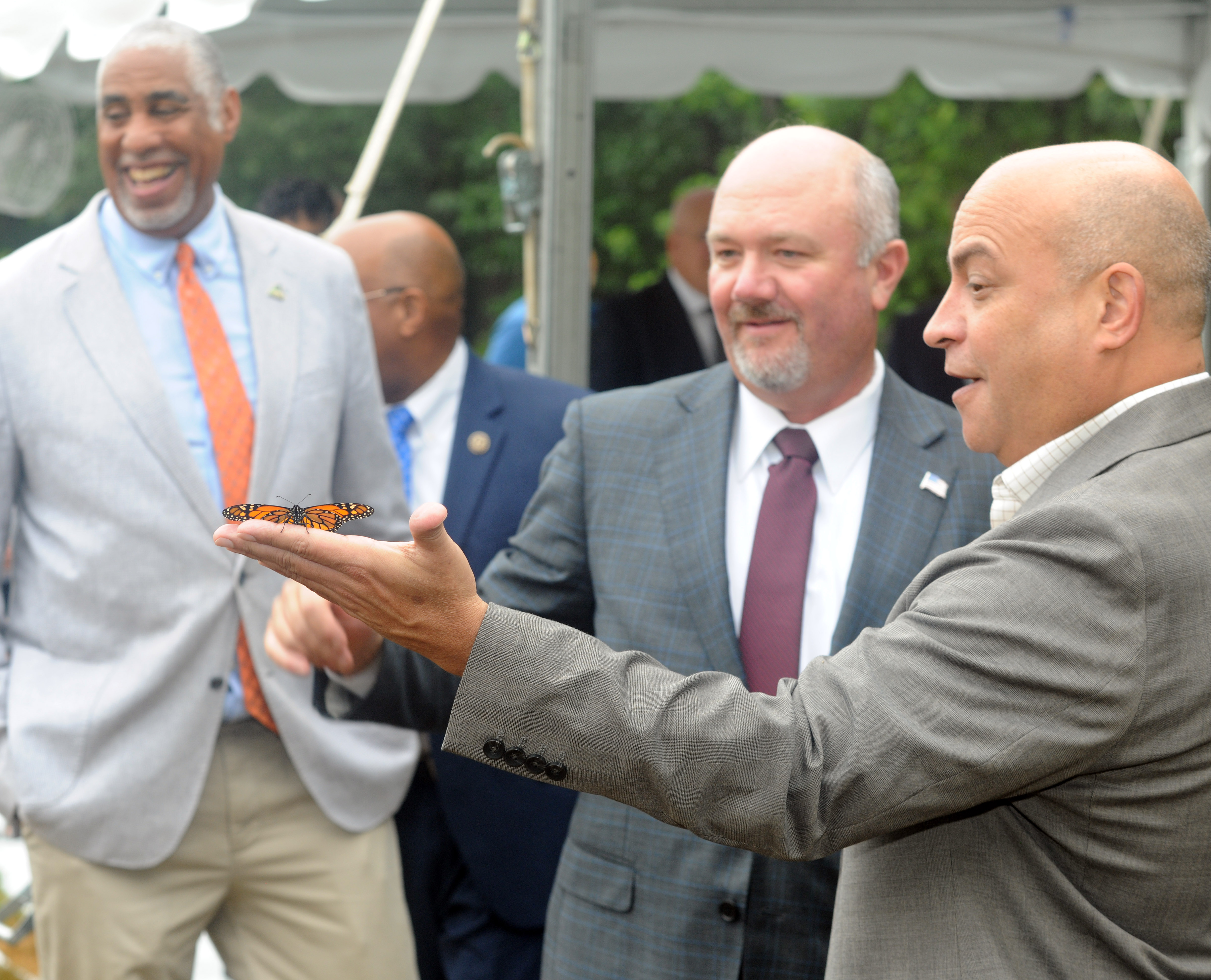
NASA Transfers ‘Hundred Acre Wood’ to Patuxent Research Refuge
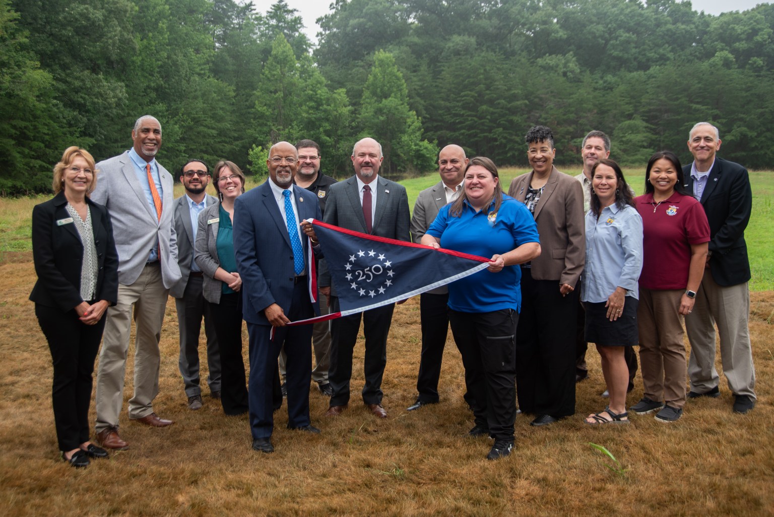
NASA ceremonially transferred ownership of about 105 acres of wooded land at its Goddard Space Flight Center’s Greenbelt, Maryland, campus Tuesday to the adjoining Patuxent Research Refuge, managed by the U.S. Fish and Wildlife Service.
The property, formerly known as NASA Goddard’s Area 400, is now part of the largest block of unfragmented forest between Washington and Baltimore. The nearly 13,000-acre woodland is the nation’s only refuge specifically established to support wildlife research. The refuge also supports recreational uses, such as walking, biking, horseback riding, fishing, and hunting.
“For over six decades, NASA Goddard has helped shape humanity’s understanding of Earth,” said Jamie Dunn, center director, NASA Goddard. “We’re glad to present this land to our colleagues in the Fish and Wildlife Service, whose conservation and research helps do the real legwork in preserving our Blue Marble for future generations.”
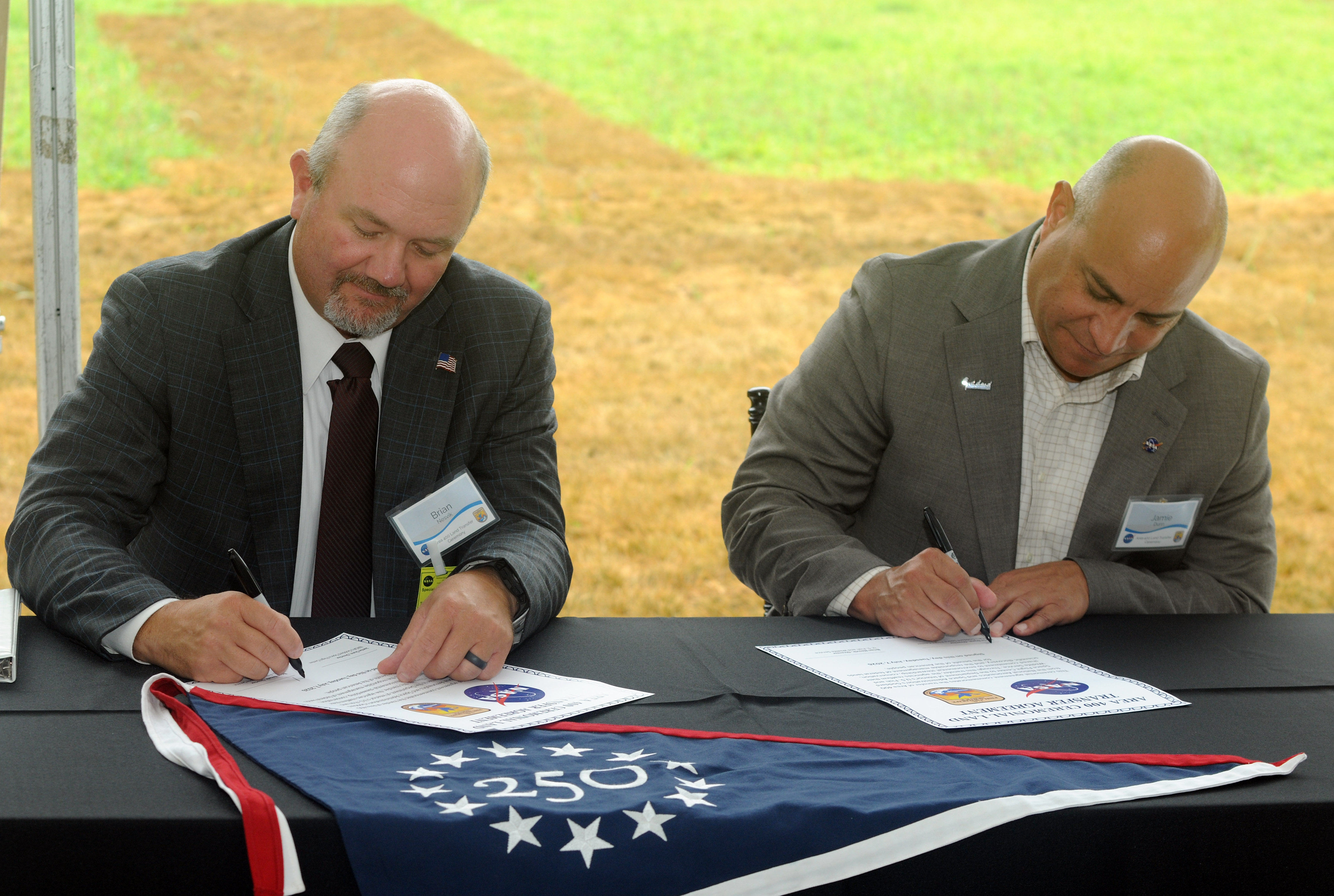
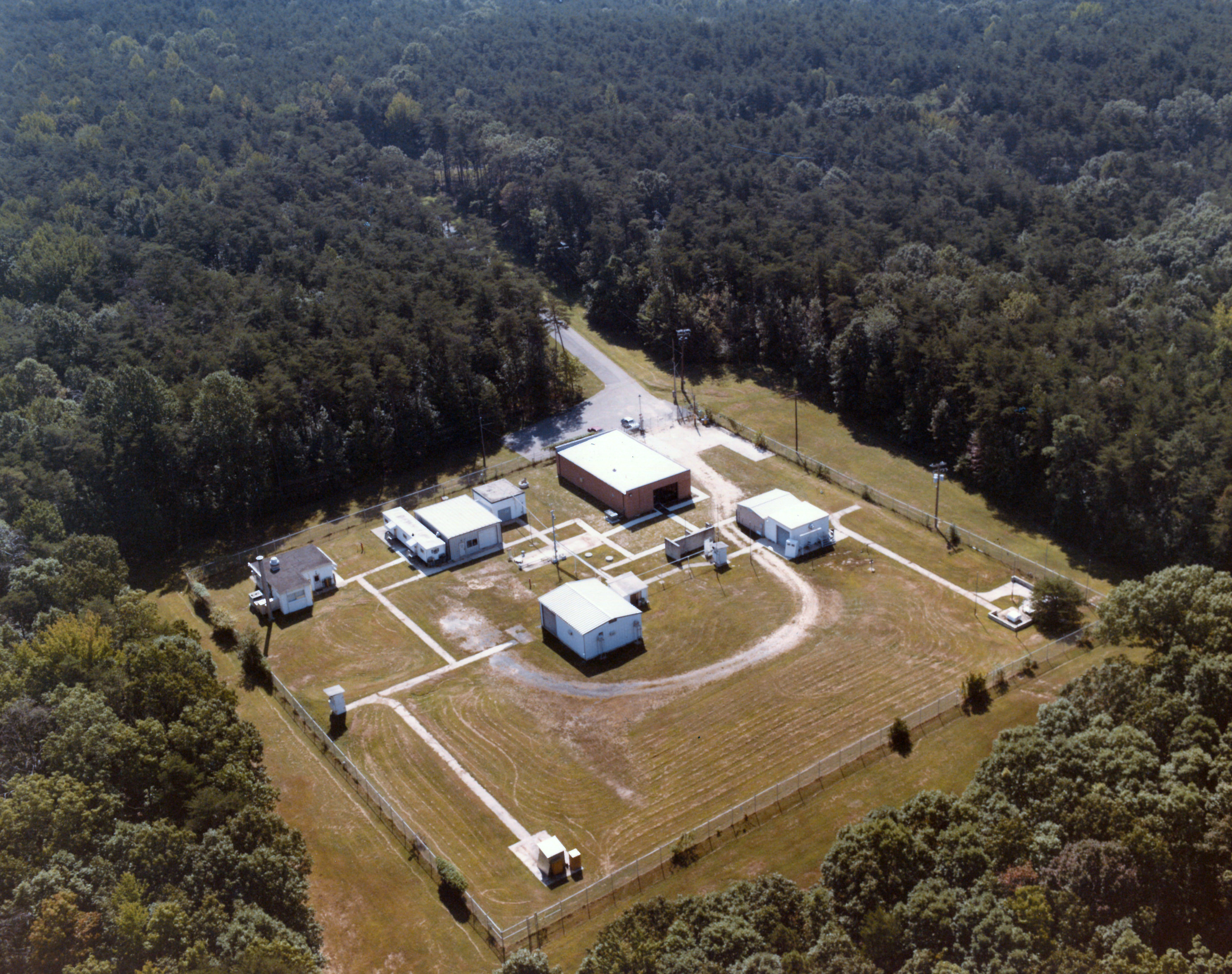
NASA Goddard had used Area 400 for propellant research beginning in the 1960s. That work has largely since shifted to NASA facilities in other states or to commercial providers, and the property had long been a candidate for divestment. NASA and the Service began discussing a potential transfer in 2021.
Prior to the transfer, Area 400 was still almost entirely wooded aside from a two-and-a-half-acre clearing with 11 small structures. The interagency transfer was effective on Feb. 23, and NASA recently completed its final closeout activities at the property, deconstructing the buildings, roadway, and utility service.
“Through working with partners on the best use of land, as exemplified with this land transfer, we can continue to conserve America’s natural beauty and expand outdoor recreation opportunities for future generations,” said U.S. Fish and Wildlife Service Director Brian Nesvik.
Media contacts:
Rob Garner
News Chief, Office of Communications
NASA’s Goddard Space Flight Center
Keith Shannon
Regional Communications Lead – U.S. Fish and Wildlife Service Northeast Region
U.S. Department of the Interior
NASA’s New Horizons Spacecraft Wakes from Hibernation in Good Health
2026-07-07 17:48
3 min read
NASA’s New Horizons Spacecraft Wakes from Hibernation in Good Health
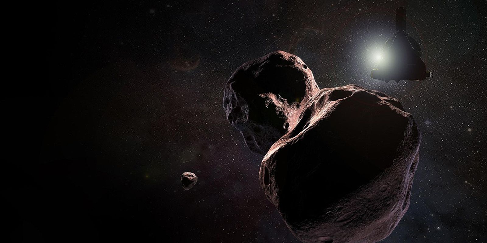
Following its longest hibernation period ever of nearly a year, NASA’s New Horizons spacecraft has emerged in good health and is ready to begin transmitting science data gathered in the distant Kuiper Belt far beyond Pluto.
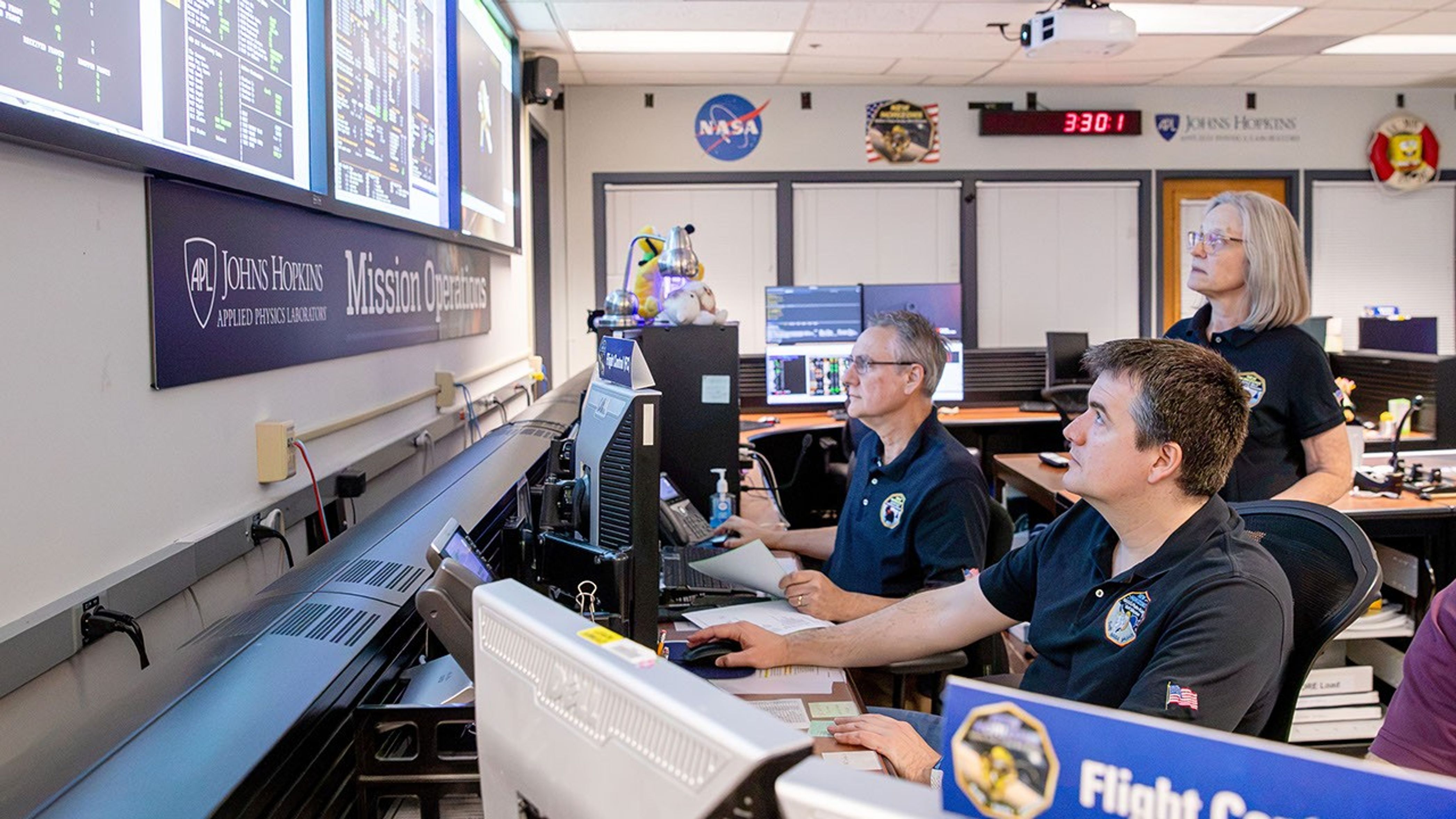
On June 23, flight controllers at the Johns Hopkins Applied Physics Laboratory (APL) in Laurel, Maryland, confirmed New Horizons, acting on stored commands uplinked to its main computer last July, had safely awakened from a 321‑day hibernation period that began Aug. 7. With the spacecraft now approximately 5.9 billion miles (9.5 billion kilometers) from Earth, the radio signals carrying that confirmation took about 8 hours and 52 minutes to reach the APL Mission Operations Center via NASA’s Deep Space Network station near Madrid, Spain.
The mission team typically places New Horizons in resource‑saving hibernation mode during long cruise periods. While the spacecraft is hibernating, operators do not send commands or retrieve data, but the spacecraft continues gathering and storing data around the clock from its heliospheric plasma sensors, Solar Wind at Pluto and the Pluto Energetic Particle Spectrometer Science Investigation, as well as its space dust detector, the Venetia Burney Student Dust Counter.
Alice Bowman, the New Horizons mission operations manager at APL, said the spacecraft reported back to Earth, via the Deep Space Network, with a weekly status beacon. “Every status report through this hibernation period was ‘green,’ meaning all was well aboard New Horizons each and every week,” she said.
As New Horizons resumes active operations, Bowman noted, the team will begin downlinking spacecraft health and safety data, followed by data from the three scientific instruments. In about three weeks, the spacecraft’s onboard Alice ultraviolet spectrograph will look at the hydrogen gas distribution in the outer heliosphere, while the Solar Wind at Pluto, the Pluto Energetic Particle Spectrometer Science Investigation, and the Venetia Burney Student Dust Counter instruments continue their measurements, and the ground team conducts a series of spacecraft and instrument checkouts.
The team also is completing upgrades to the ground‑system software that will make it easier to maintain operations of the spacecraft. Tests are already underway and are expected to continue through the year.
New Horizons is operating on updated autonomy logic designed for operations farther from the Sun and to accommodate the expected reduction in power and the naturally occurring increase in radio‑signal travel time.
The NASA spacecraft’s exploration of this distant region of the solar system marks the latest step in a journey that began in January 2006 with the fastest launch on record; a flyby of Jupiter in February 2007 that included stunning views of the gas giant and its moons; the first exploration through the Pluto system in July 2015; the first exploration of a Kuiper Belt object, Arrokoth, in January 2019, and unique studies of the Sun’s outer heliosphere and dozens of additional Kuiper Belt objects since then.
For more information on NASA’s New Horizons mission, visit:

Artemis II Crew and Apollo 14 Moon Tree
2026-07-07 16:16
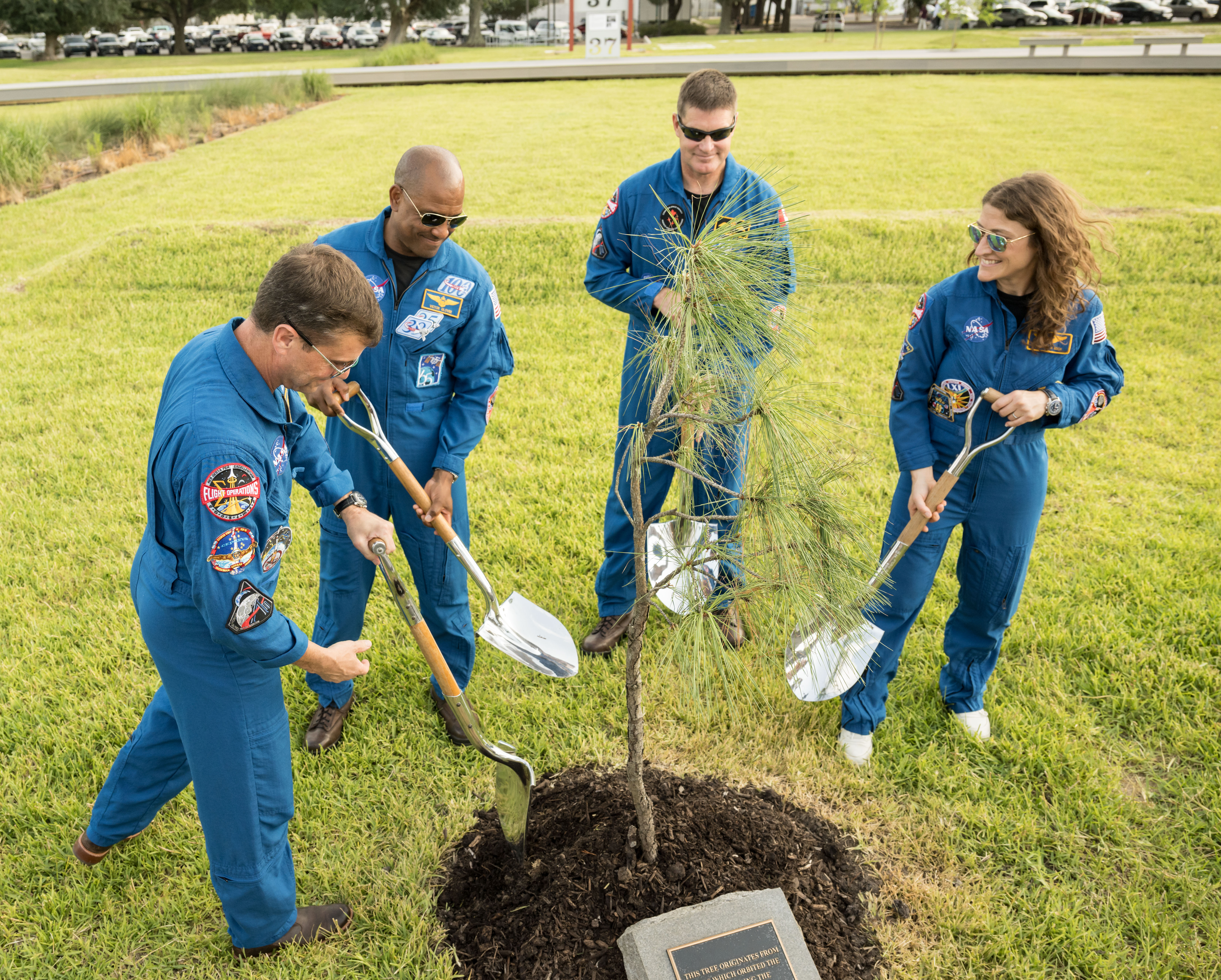
In this photograph, the Artemis II crew participates in the dedication of the Apollo 14 Moon tree at the Lunar Receiving Park at NASA’s Johnson Space Center on June 25, 2026. This tree is a second-generation Apollo Moon tree of the loblolly pine species. The original Apollo Moon trees were grown from seeds carried aboard Apollo 14 by NASA astronaut Stuart Roosa, a former U.S. Forest Service smoke jumper. Upon return to Earth, the seeds were germinated by the Forest Service, and the resulting seedlings were planted throughout the United States and around the world.
Image credit: NASA/James Blair
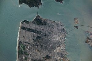
July 2026 Satellite Puzzler
2026-07-07 15:48

Every month, NASA Earth Observatory features a puzzling satellite image. The July 2026 puzzler appears above.
Your Challenge
Identify the location shown in this satellite image. Share what clues you see, where you think it is, and what makes this place interesting or unique to you.
How to Answer
Submit your response using this form and select “Puzzler Answer” as the topic. Please include your preferred name or alias.
You can keep it simple and just guess the location. Want to impress us? Tell us which satellite and instrument captured the image, which spectral bands were used, or point out a subtle detail about the geology or history of the area. If something catches your eye, or if this is your home or means something to you, we’d love to hear about it.
The Prize
We can’t offer prize money or a trip to space to see Earth like satellites and astronauts do. But we can offer something almost as rewarding: puzzler bragging rights.
About a week after the challenge, we’ll post the answer at the top of this page, along with a link to an Earth Observatory Image of the Day story that explains the image in more detail. We’ll recognize the first person who correctly guesses the location, and we may also highlight readers who share especially thoughtful or interesting answers. By submitting a response, you acknowledge that your comments may be edited, excerpted, and published on this page.
Until then, zoom in, look closely, and enjoy the challenge. See you at the reveal!
The World Cup From 250 Miles Up
2026-07-07 04:00

In summer 2026, sixteen stadiums across North America hosted matches as part of the FIFA World Cup. Over the years, astronauts aboard the International Space Station have captured a top-down view of the infrastructure, landscapes, and ecosystems surrounding many of these venues.
Six of the matches were played at the San Francisco Bay Area Stadium, beginning on June 13 with a match-up between Qatar and Switzerland. This stadium (also called Levi’s Stadium) is located in Santa Clara, California, adjacent to San Jose and around 40 miles (64 kilometers) south of San Francisco. An astronaut aboard the International Space Station took this photo (above) on July 26, 2022.
The stadium, completed in 2014, is surrounded by a mix of recreational, housing, and business infrastructure. The scene includes the southern part of San Francisco Bay, which is 23 years into a 50-year effort to restore up to 90 percent of the region’s salt ponds to tidal wetlands and marshlands, while retaining some of its salt-making heritage.
The Bay Area hosted its sixth and final World Cup match on July 1, when the U.S. faced off against Bosnia and Herzegovina in a knockout match. The U.S. advanced to the round of 16 following a 2-0 win.

The FIFA World Cup final is scheduled for July 19 at New York New Jersey Stadium, part of the Meadowlands Sports Complex, in East Rutherford, New Jersey. The stadium (also called MetLife Stadium) sits along the New Jersey Turnpike, west of Midtown Manhattan. Note that north is toward the bottom-right of this photo, captured by an astronaut on April 17, 2022.
The area has seen centuries of human impact. Colonists cleared wetlands and cedar forest for settlements, and development for a range of economic and industrial uses followed. In the 20th century, it became an unregulated dumping ground. In recent decades, though, wetland restoration efforts have occurred alongside the development of the sports and entertainment complex.
Other World Cup host cities have also appeared in astronaut photography and satellite imagery. Guadalajara Stadium (Estadio Akron), Los Angeles Stadium (SoFi Stadium), Houston Stadium (NRG Stadium/Reliant Stadium), and BC Place Vancouver (BC Place) are among the venues that have been observed from above.
Astronaut photograph ISS067-E-202213 was acquired on July 26, 2022, with a Nikon D5 digital camera using a focal length of 400 millimeters, and astronaut photograph ISS067-E-18580 was acquired on April 17, 2022, with a Nikon D5 digital camera using a focal length of 1150 millimeters. They are provided by the ISS Crew Earth Observations Facility and the Earth Science and Remote Sensing Unit at NASA Johnson Space Center. The images were taken by a member of the Expedition 67 crew. The images have been cropped and enhanced to improve contrast, and lens artifacts have been removed. The International Space Station Program supports the laboratory as part of the ISS National Lab to help astronauts take pictures of Earth that will be of the greatest value to scientists and the public, and to make those images freely available on the Internet. Additional images taken by astronauts and cosmonauts can be viewed at the NASA/JSC Gateway to Astronaut Photography of Earth. Story by Kathryn Hansen.


References & Resources
- NASA (2026, July 1) NASA Data Helps CDC Track Air Quality During World Cup 2026. Accessed July 6, 2026.
- NASA Earth Observatory (2026, June 12) World Cup Fever in Guadalajara. Accessed July 6, 2026.
- NASA Earth Observatory (2023, March 5) New York and New Jersey. Accessed July 6, 2026.
- NASA Earth Observatory (2016, February 11) From Salt Production to Salt Marsh. Accessed July 6, 2026.
- New Jersey Sports and Exposition Authority (2023) History. Accessed July 6, 2026.
- U.S. Geological Survey (2023) Monitoring Nesting Waterbirds for the South Bay Salt Pond Restoration Project: 2022 Breeding Season. Accessed July 6, 2026.
You may also be interested in:
Stay up-to-date with the latest content from NASA as we explore the universe and discover more about our home planet.

An astronaut on the International Space Station was surprised to photograph a shower of light streaking through the darkness while…
Urban development, green spaces, and maritime activity converge in this Northern California city.

An astronaut’s photo, taken en route to the Moon, reveals our planet and its place in space in a novel…


TechCrunch - Latest
Why the rise of open source AI isn’t hurting Anthropic … yet
2026-07-07 20:04
Microsoft joins AI cost-cutting trend by relying more on its own models
2026-07-07 19:58
Discord admits AI moderation bug wrongfully banned users over harmless images
2026-07-07 19:28
Google’s Pixel event is set for August 12
2026-07-07 18:38
Figma acquires team behind a vibe-coding app
2026-07-07 18:37