📰 Trending Topics
Google News - Trending
Google News - Technology
Apple Seeds Third iOS 27 and iPadOS 27 Betas to Developers - MacRumors
2026-07-06 17:24
- Apple Seeds Third iOS 27 and iPadOS 27 Betas to Developers MacRumors
- iOS 27 public beta release date: When you can install the new iPhone update 9to5Mac
- You can now customize Siri’s pace and expressivity in the latest iOS 27 beta TechCrunch
- New in iOS 27 beta 3: Siri AI voice customization options AppleInsider
- The Difference Between the iOS 27 Public and Developer Betas Geeky Gadgets
Galaxy Watch 9 and Watch Ultra 2 will follow foldables in price increase, leak says - 9to5Google
2026-07-06 15:34
- Galaxy Watch 9 and Watch Ultra 2 will follow foldables in price increase, leak says 9to5Google
- Samsung's Galaxy Z Fold 8 Ultra Needs These Upgrades to Win Me Over CNET
- Samsung Teases Wide-As-Hell New Foldable Engadget
- Price Increases are Coming for Samsung’s Galaxy Z Fold 8 Foldables Droid Life
- New report suggests Samsung's Galaxy Z Fold 8 and Z Flip 8 prices will be just as bad as you think PhoneArena
Samsung confirms the names of the Galaxy Watch9, Galaxy Watch Ultra2, and Galaxy Able - GSMArena.com news - GSMArena.com
2026-07-06 14:13
- Samsung confirms the names of the Galaxy Watch9, Galaxy Watch Ultra2, and Galaxy Able - GSMArena.com news GSMArena.com
- Samsung’s First Bone-Conduction Earbuds May Be Called Galaxy Able SammyGuru
- Samsung’s next three wearables are practically official, but this one will surely surprise you PhoneArena
- Samsung Quietly Confirms Radical 'Galaxy Able' Wearable Forbes
- All set: Samsung's Wearables app looks much better in this leak Android Central
The foldable iPhone may be in short supply upon release - Yahoo Tech
2026-07-06 17:30
- The foldable iPhone may be in short supply upon release Yahoo Tech
- Apple's iPhone Ultra will be double the price of the iPhone 17 Pro Max, report claims Mashable
- Apple plans five new iPhones through 2027, eyes Chinese-made chips amid foldable push, reports say CNBC
- Apple's Foldable iPhone May Be In Short Supply After It Launches Engadget
- Apple (AAPL) Plans 10 Million Foldables And An iPhone Ultra Push Yahoo Finance
NASA - Breaking News
The World Cup From 250 Miles Up
2026-07-07 04:00

In summer 2026, sixteen stadiums across North America hosted matches as part of the FIFA World Cup. Over the years, astronauts aboard the International Space Station have captured a top-down view of the infrastructure, landscapes, and ecosystems surrounding many of these venues.
Six of the matches were played at the San Francisco Bay Area Stadium, beginning on June 13 with a match-up between Qatar and Switzerland. This stadium (also called Levi’s Stadium) is located in Santa Clara, California, adjacent to San Jose and around 40 miles (64 kilometers) south of San Francisco. An astronaut aboard the International Space Station took this photo (above) on July 26, 2022.
The stadium, completed in 2014, is surrounded by a mix of recreational, housing, and business infrastructure. The scene includes the southern part of San Francisco Bay, which is 23 years into a 50-year effort to restore up to 90 percent of the region’s salt ponds to tidal wetlands and marshlands, while retaining some of its salt-making heritage.
The Bay Area hosted its sixth and final World Cup match on July 1, when the U.S. faced off against Bosnia and Herzegovina in a knockout match. The U.S. advanced to the round of 16 following a 2-0 win.

The FIFA World Cup final is scheduled for July 19 at New York New Jersey Stadium, part of the Meadowlands Sports Complex, in East Rutherford, New Jersey. The stadium (also called MetLife Stadium) sits along the New Jersey Turnpike, west of Midtown Manhattan. Note that north is toward the bottom-right of this photo, captured by an astronaut on April 17, 2022.
The area has seen centuries of human impact. Colonists cleared wetlands and cedar forest for settlements, and development for a range of economic and industrial uses followed. In the 20th century, it became an unregulated dumping ground. In recent decades, though, wetland restoration efforts have occurred alongside the development of the sports and entertainment complex.
Other World Cup host cities have also appeared in astronaut photography and satellite imagery. Guadalajara Stadium (Estadio Akron), Los Angeles Stadium (SoFi Stadium), Houston Stadium (NRG Stadium/Reliant Stadium), and BC Place Vancouver (BC Place) are among the venues that have been observed from above.
Astronaut photograph ISS067-E-202213 was acquired on July 26, 2022, with a Nikon D5 digital camera using a focal length of 400 millimeters, and astronaut photograph ISS067-E-18580 was acquired on April 17, 2022, with a Nikon D5 digital camera using a focal length of 1150 millimeters. They are provided by the ISS Crew Earth Observations Facility and the Earth Science and Remote Sensing Unit at NASA Johnson Space Center. The images were taken by a member of the Expedition 67 crew. The images have been cropped and enhanced to improve contrast, and lens artifacts have been removed. The International Space Station Program supports the laboratory as part of the ISS National Lab to help astronauts take pictures of Earth that will be of the greatest value to scientists and the public, and to make those images freely available on the Internet. Additional images taken by astronauts and cosmonauts can be viewed at the NASA/JSC Gateway to Astronaut Photography of Earth. Story by Kathryn Hansen.


References & Resources
- NASA (2026, July 1) NASA Data Helps CDC Track Air Quality During World Cup 2026. Accessed July 6, 2026.
- NASA Earth Observatory (2026, June 12) World Cup Fever in Guadalajara. Accessed July 6, 2026.
- NASA Earth Observatory (2023, March 5) New York and New Jersey. Accessed July 6, 2026.
- NASA Earth Observatory (2016, February 11) From Salt Production to Salt Marsh. Accessed July 6, 2026.
- New Jersey Sports and Exposition Authority (2023) History. Accessed July 6, 2026.
- U.S. Geological Survey (2023) Monitoring Nesting Waterbirds for the South Bay Salt Pond Restoration Project: 2022 Breeding Season. Accessed July 6, 2026.
You may also be interested in:
Stay up-to-date with the latest content from NASA as we explore the universe and discover more about our home planet.

An astronaut on the International Space Station was surprised to photograph a shower of light streaking through the darkness while…

Urban development, green spaces, and maritime activity converge in this Northern California city.

An astronaut’s photo, taken en route to the Moon, reveals our planet and its place in space in a novel…


NASA Takes Flight For America’s 250th
2026-07-06 18:38
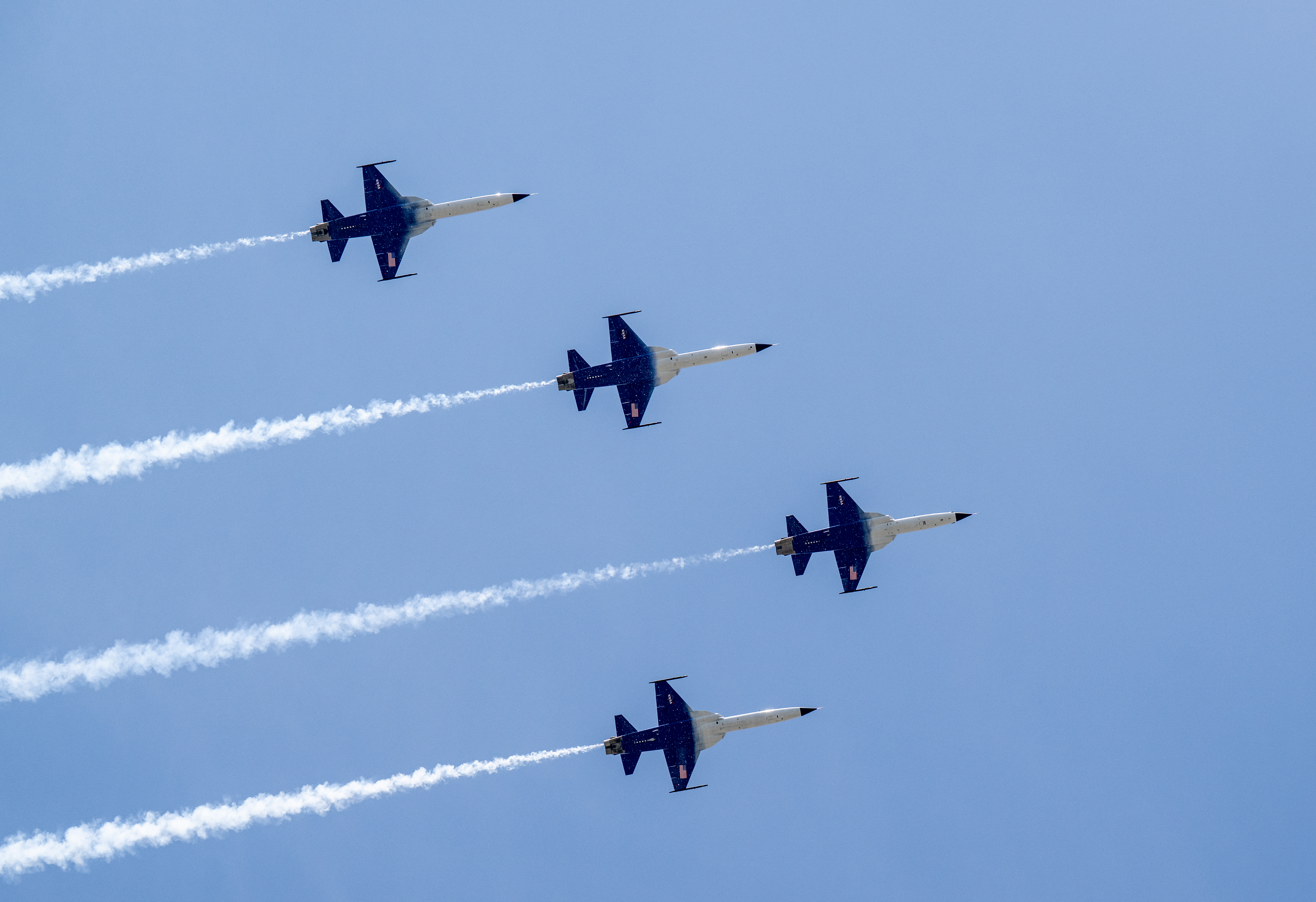
NASA Administrator Jared Isaacman leads a flyover featuring his personally owned Northrop F-5 Tiger during the Great American State Fair on July 4, 2026, on the National Mall in Washington, D.C.
For 250 years, America has pushed the boundaries of what’s possible. From the earliest days of exploration, to the first steps on the Moon and the missions shaping our future, NASA represents the spirit of discovery that defines our nation.
As the United States celebrates its semiquincentennial, Freedom 250 highlights how innovation, courage, and scientific leadership have carried America forward — and how NASA continues to expand the frontier for the next generation.
NASA Seeks Industry Input on Second Phase of Commercial Space Stations
2026-07-06 15:33

On Monday, NASA released a draft Request for Proposals (RFP) seeking feedback from American companies on the next phase of its commercial space stations strategy, aimed at ensuring a seamless transition of activities in low Earth orbit from the International Space Station.
“NASA’s review reflects what we’ve been hearing from industry throughout this process. Industry believes it can meet the timelines and that a viable commercial marketplace exists where NASA is one customer among many,” said NASA Administrator Jared Isaacman. “We’re focused on supporting those efforts, enabling the capabilities that make this transition possible, and doing all we can to ensure the United States maintains a continuous human presence in low Earth orbit.”
The draft RFP builds on the agency’s request for information released March 25. Based on industry’s input, NASA will proceed with its original plan to procure commercial services through FAR-based contract(s) awarded via full and open competition. Industry has indicated there is significant capital investment behind this approach and expressed high confidence in their ability to attract additional capital investment and expand future market opportunities after NASA makes an award.
NASA intends to award firm-fixed-price, multi-award, indefinite-delivery/indefinite-quantity contracts supporting development, certification, and services. This approach would allow NASA to select two or more contractors through early development, followed by a competitive task order for final design, test, evaluation, as well as certification and services from one or more contractors.
Industry feedback is due Monday, July 27. NASA also will hold an informational industry briefing on Thursday, July 9, at the agency’s Johnson Space Center in Houston to provide a top-level summary of the documents and expectations.
The draft RFP gives companies the opportunity to review and comment on the planned acquisition approach for future commercial space station services, helping shape the agency’s path forward as it proceeds with its original commercial strategy. This strategy will provide the government with reliable, safe, cost-effective services through commercial partners, enabling NASA to focus on the next step in humanity’s deep space exploration while also continuing to use low Earth orbit as an ideal training environment and proving ground for Artemis missions to the Moon and future human exploration of Mars.
Learn more about commercial space stations at:
https://www.nasa.gov/commercialspacestations
Share
Details
Related Terms
NASA’s CAPSTONE Completes Extended Mission Testing Lunar Technologies
2026-07-06 15:00
NASA’s CAPSTONE Completes Extended Mission Testing Lunar Technologies
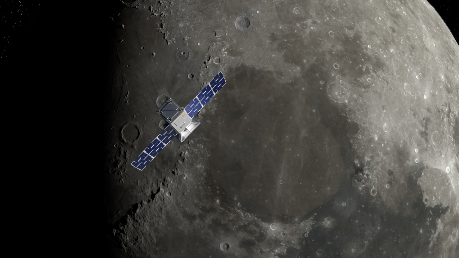
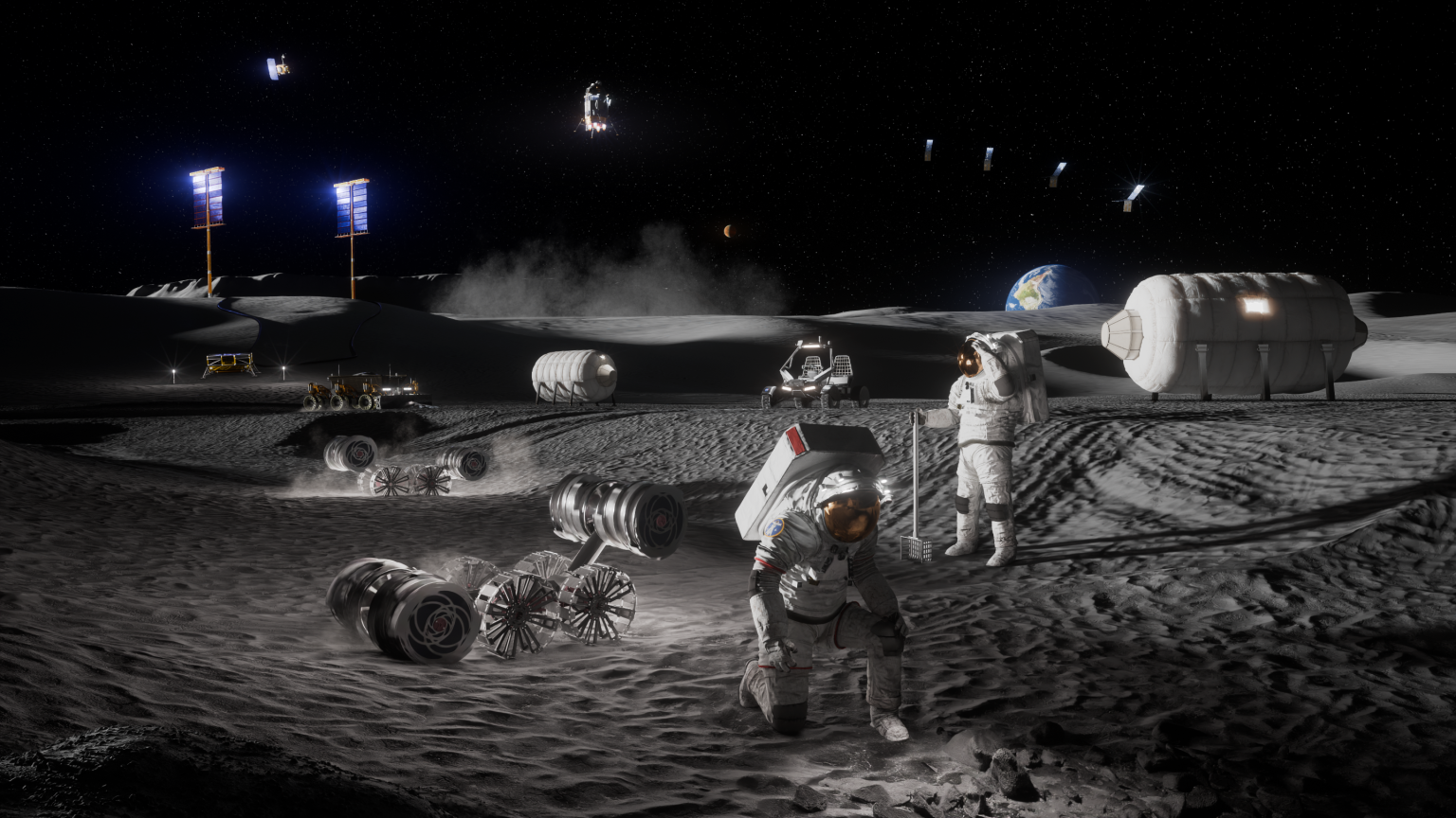
As NASA prepares for a sustained human presence on the Moon, missions will increasingly require spacecraft that can navigate and communicate without a direct connection to Earth.
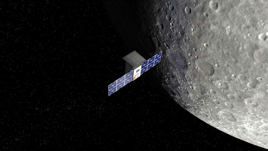
NASA’s Cislunar Autonomous Positioning System Technology Operations and Navigation Experiment, or CAPSTONE, validated and advanced these capabilities.
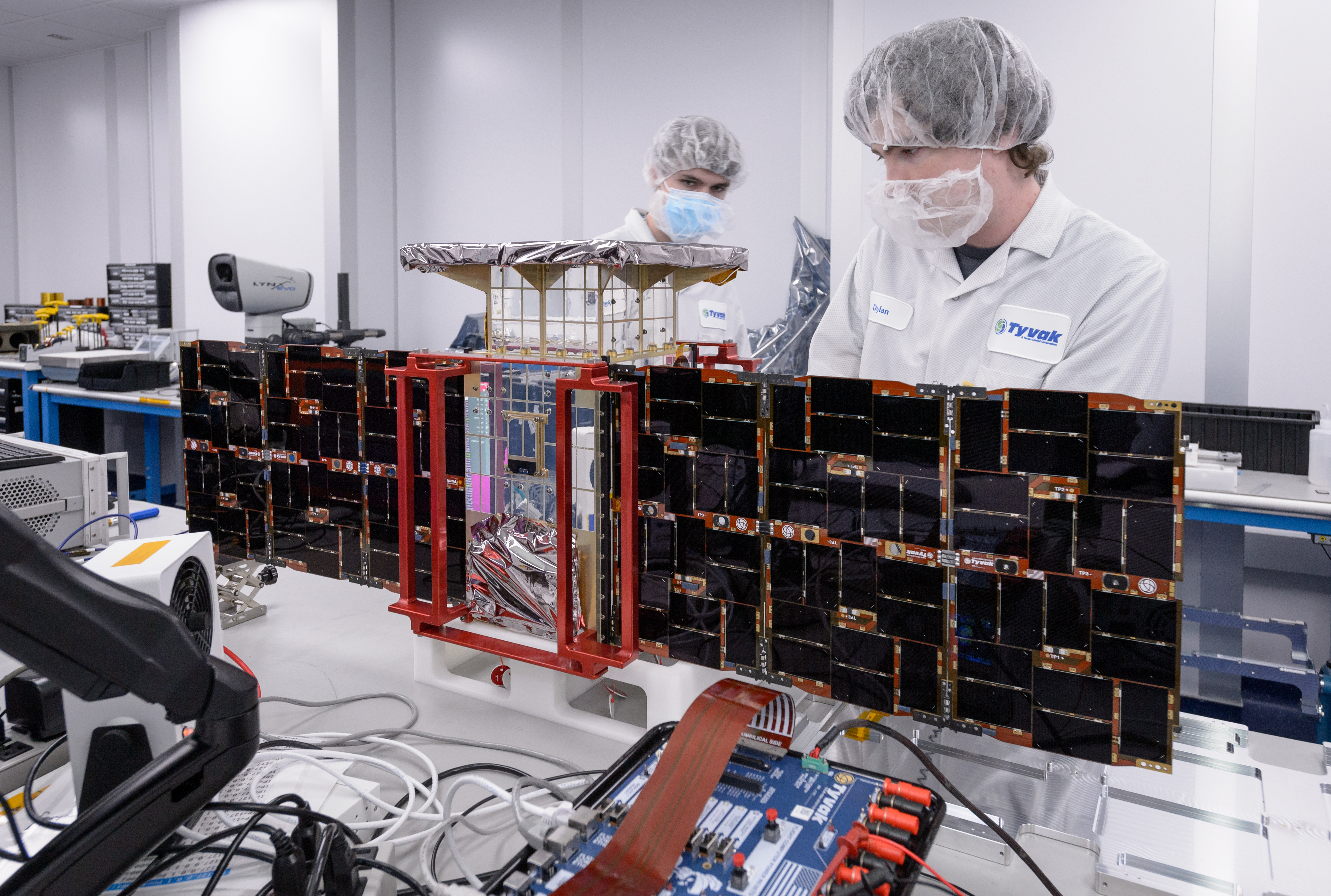
Designed to test and validate technologies in lunar orbit, CAPSTONE launched in June 2022 and became the first U.S. commercial mission at the Moon. The spacecraft tested operations in three-body orbits around the Moon, using the combined gravity of Earth and the Moon to reduce the fuel needed to maintain a stable lunar path. It became the first spacecraft to fly and characterize this orbit for future exploration and science missions. Owned and operated by Advanced Space, the microwave-sized spacecraft then received a 15-month mission extension, becoming a testbed for advanced communications, networking, autonomous navigation, and software-defined satellite technologies.
Rather than launch a new satellite, NASA’s Research and Technology Mission Directorate demonstrated that CAPSTONE’s existing hardware could host new applications after launch, transforming the spacecraft into a cost-effective, flexible lunar technology demonstration platform. NASA’s SCaN (Space Communications and Navigation) Division will now use the data to demonstrate innovative networking and navigation techniques on future experiments.
“Operating multiple experiments simultaneously aboard the same spacecraft allows NASA to evaluate how these technologies perform together in a real lunar environment,” said Greg Stover, director of the Advanced Research and Technology Division within NASA’s Research and Technology Mission Directorate at NASA Headquarters in Washington. “Investments in autonomous operations and resilient communications infrastructure are essential to ensuring U.S. leadership as activity around the Moon continues to increase.”
Two experiments aboard CAPSTONE used software-defined infrastructure to advance two future mission essentials: autonomous navigation and deep space communications. The autonomous Navigation, Guidance, and Control software, or autoNGC, is designed to allow a spacecraft to determine where it is, where it is going, and how to get where it needs to be without waiting for instructions from the ground. While portions of the software had previously flown in Earth orbit, CAPSTONE marked the first time autoNGC was tested at the Moon.
“To really demonstrate that something works, you have to fly it,” said Sun Hur-Diaz, principal investigator for the autoNGC technology development project at NASA’s Goddard Space Flight Center in Greenbelt, Maryland. “The real environment is key.”
To really demonstrate that something works you have to fly it. The real environment is key.

Sun Hur-Diaz
Principal Investigator for the autoNGC Project, NASA Goddard Space Flight Center
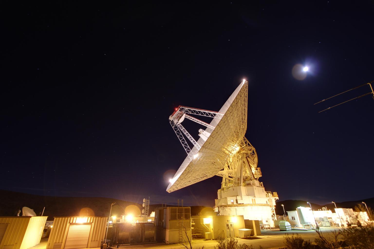
Researchers also evaluated how autoNGC performed with limited contact to Earth. While NASA’s Deep Space Network antennas were supporting the Artemis II crewed test flight around the Moon, CAPSTONE’s communications window dropped to just a few passes per week.
Those gaps became one of the experiment’s most valuable tests. Without data from Earth, autoNGC determined CAPSTONE’s location using an onboard star tracker camera to image the Moon, Earth, and other celestial bodies. The camera-based system, known as optical navigation, at times outperformed ground-based methods for real-time onboard navigation, advancing technologies for future deep-space missions.
Alongside autonomous navigation testing, CAPSTONE also tested delay/disruption tolerant networking (DTN), a communications architecture designed for deep space. Unlike Earth-based internet systems, deep space communications must function despite long delays and frequent signal gaps. The DTN system addresses those challenges by storing information on the spacecraft when no connection is available and automatically forwarding it once communications are restored. With these demonstrations, CAPSTONE became the first to fly the latest DTN protocols beyond Earth orbit and the first to run them in NASA’s core Flight System, an open-source framework that can be implemented on any spacecraft.
In one demonstration, engineers began transmitting data from CAPSTONE to Earth, but the connection ended before the transfer was complete. The spacecraft stored the remaining data until the next communications opportunity, and transmission resumed automatically. Every piece of data made it home.

“You can imagine an astronaut walking behind a lunar hill or descending into a crater and temporarily losing connectivity,” said Ben Anderson, a systems engineer for the Near Space Network at NASA’s Goddard Space Flight Center in Greenbelt, Maryland. “This technology allows that data to be automatically retransmitted once communications are restored.”
In addition to its primary achievements, CAPSTONE’s second life as a software-defined testing platform demonstrated that new technologies can be affordably tested and proven directly in their operational environment.
After nearly four years of technology maturation, NASA’s activities on CAPSTONE concluded in June 2026, while Advanced Space will continue to use the spacecraft as a technology development testbed.
The CAPSTONE spacecraft was designed and built by Terran Orbital and is owned and operated by Advanced Space. NASA’s Research and Technology Mission Directorate managed the mission through the Small Spacecraft and Distributed Systems program, based at NASA’s Ames Research Center in California’s Silicon Valley. Elements of the CAPSTONE technology suite were supported by NASA’s Small Business Innovation Research program. The autoNGC and DTN demonstrations conducted during CAPSTONE’s extended mission were managed by NASA’s SCaN Division, based at NASA Headquarters in Washington.
About the Author
Korine Powers
Korine Powers, Ph.D. is a writer for NASA's SCaN (Space Communications and Navigation) Program office and covers emerging technologies, commercialization efforts, exploration activities, and more.
Share
Details
Related Terms
Explore More

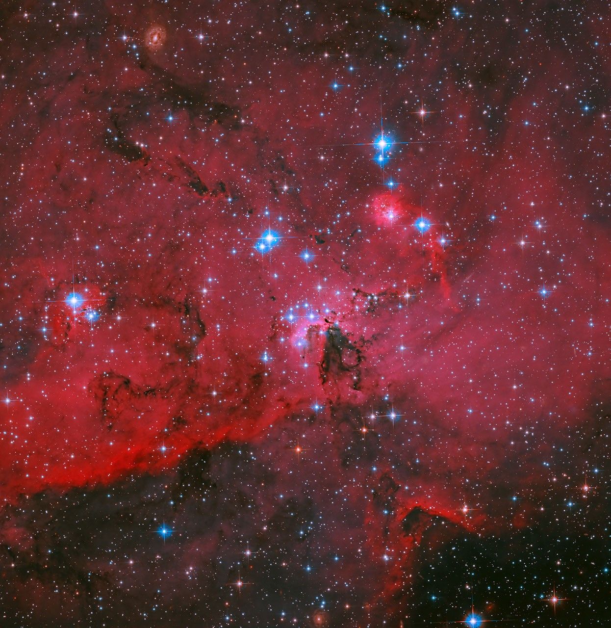
NASA Webb Uncovers Unusual Galaxy Shaped by Cosmic Collision
2026-07-06 14:00
6 min read
NASA Webb Uncovers Unusual Galaxy Shaped by Cosmic Collision
NASA Webb Uncovers Unusual Galaxy Shaped by Cosmic Collision
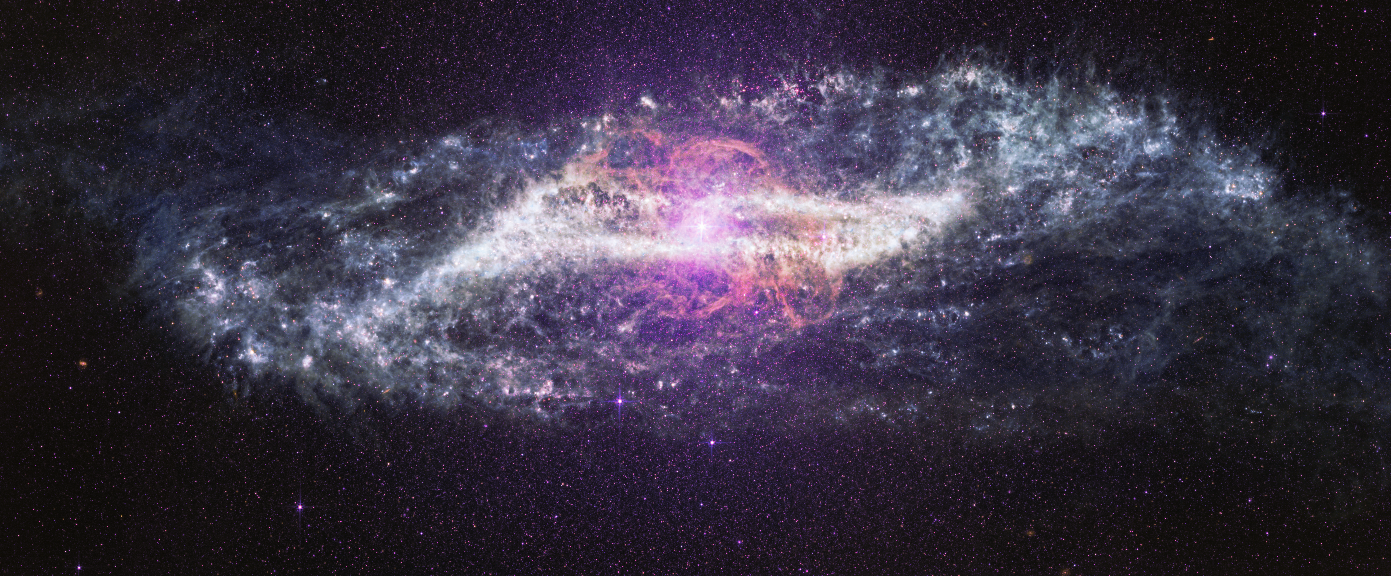
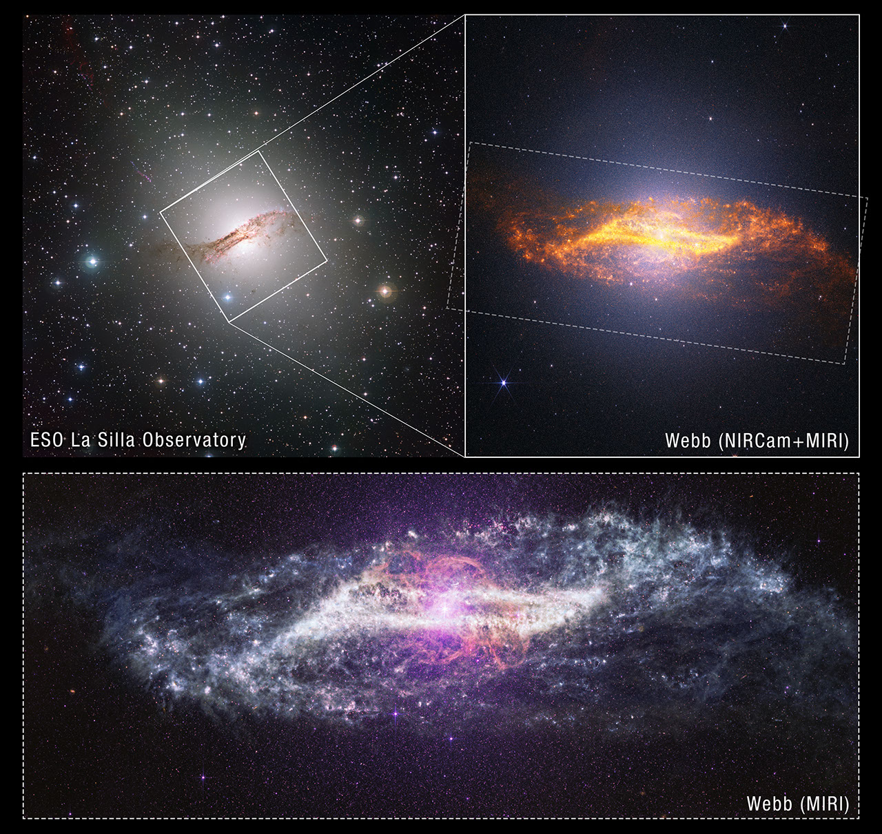
Image: NASA, ESA, CSA, STScI; Image Processing: Alyssa Pagan (STScI), Joseph DePasquale (STScI), Macarena Garcia Marin (ESA Office at STScI)
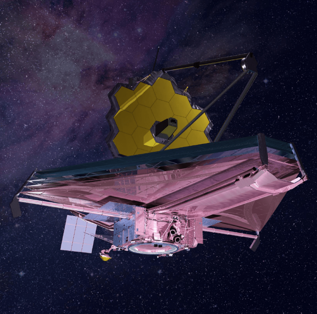
In new images from NASA’s James Webb Space Telescope to celebrate its fourth science anniversary, a familiar galaxy transforms into something far richer, and far more complex, than ever seen before. Webb’s unprecedented sensitivity across near- and mid-infrared wavelengths cuts through the thick lanes of dust that obscure Centaurus A’s center in visible light, showing a densely packed tapestry of individual stars and an active, everchanging galaxy. These images mark four years of better-than-anticipated performance and successful science operations for the most powerful space telescope in history.
Centaurus A is 11 million light-years away from Earth, relatively close in cosmic terms. Yet, unlike most nearby galaxies, it is very active, making it a powerful laboratory for understanding how galaxies and black holes grow and evolve together.
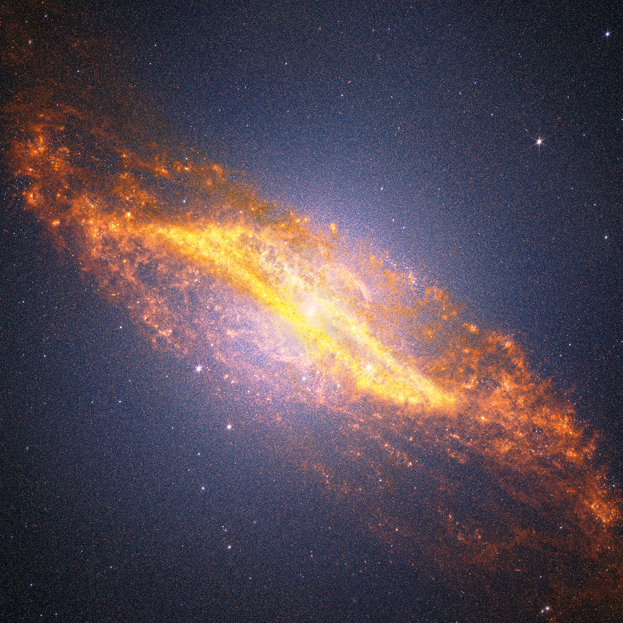
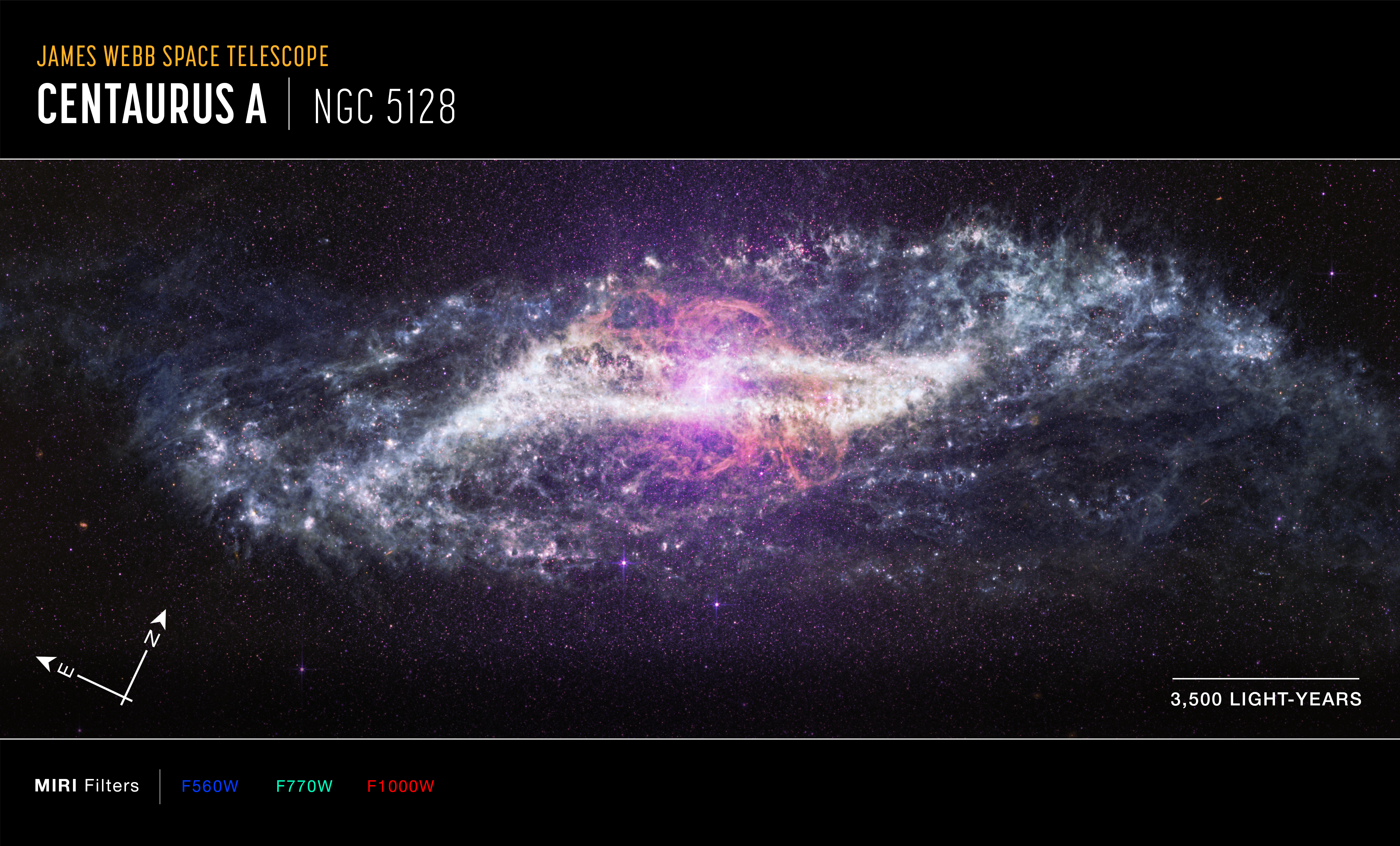
Image: Centaurus A (MIRI Image)
At its core sits a supermassive black hole actively feeding on surrounding material. As it does, the black hole launches powerful jets and releases enormous amounts of energy, shaping the galaxy around it. At the same time, Centaurus A bears the scars of a dramatic past: a major collision with another galaxy roughly two billion years ago. The aftermath of that merger is still visible today in its unusual structure and ongoing star formation.
Visible light observations from NASA’s Hubble Space Telescope could not reveal the central region where dust blocked the view, while NASA’s retired Spitzer Space Telescope revealed large scale structures in the infrared without resolving individual stars. Now, Webb brings both clarity and depth, exposing the galaxy’s inner workings star by star.
Interactive: Journey into Centaurus A
“No single telescope tells the whole story,” said Shawn Domagal-Goldman, division director, Astrophysics, NASA Headquarters in Washington. “Discoveries build over time and new observatories expand on the foundations laid by earlier missions. Webb represents the most powerful step forward yet, opening a window into wavelengths and details never before accessible. This allows astronomers to examine structures and processes that other telescopes could not see.”
Dust, awe
Webb’s mid-infrared vision highlights the galaxy’s rich dust structures, which glow in intricate shapes that surprise and even perplex astronomers. A warped, parallelogram-like band cuts across the galaxy’s center, while wisps of material stretch outward like cosmic clouds.
An “S” shaped feature, most notable in the image from Webb’s MIRI (Mid-Infrared Instrument), is also unusual and invites questions that need further study to answer. What created this shape? How does the black hole influence it? Is it influenced by merger-induced star formation?
Many of the glowing red points in the MIRI image are dust-rich stars or stellar nurseries, where aging stars are shedding material back into space or new stars are forming. This dust is the raw ingredient for future generations of stars and planets, making it central to the ongoing life cycle of the galaxy.
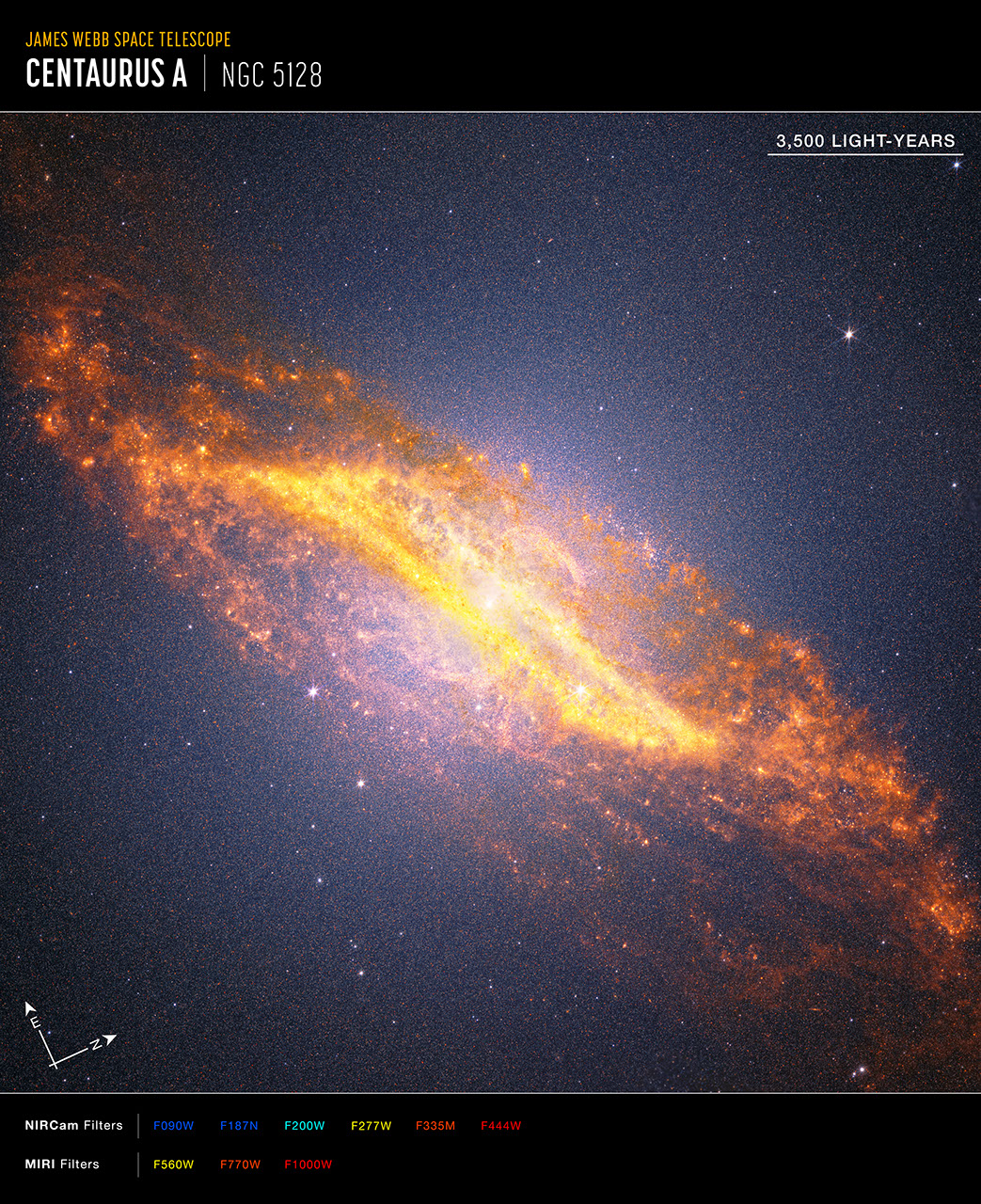
Image: Centaurus A Crop (NIRCam & MIRI)
Written in its stars
With Webb’s high resolution, astronomers can now study Centaurus A star by star, even in its long-obscured central region. What looks “grainy” in the image from Webb, most obvious in the combined MIRI and NIRCam (Near-Infrared Camera) view, is actually a densely packed field of individual stars, together carrying information about the galaxy’s past.
With Webb’s view of Centaurus A, it becomes a case of galactic archaeology. Each star revealed helps to reconstruct when different events happened: when older stars first formed, when activity slowed down, a burst of star formation during the collision, and stars born from gas stirred in its aftermath. Together, they form a timeline of the galaxy’s evolution.
Dynamic black hole
Webb’s capabilities go beyond imaging. By analyzing light with spectroscopy, astronomers can measure how gas moves within the galaxy.
Early findings from Webb show fast-moving ionized gas flowing outward, likely driven by the black hole’s activity, and warmer molecular hydrogen in a warped rotating disk near the center. These observations help explore one of astronomy’s biggest questions: How does a black hole influence an entire galaxy?
The answer appears to be complex. The black hole can trigger star formation by compressing gas, but also limit it by pushing material away. Centaurus A offers a rare, nearby view of this cosmic interplay.
By tracing dust in never-before-seen detail, resolving millions of stars, and revealing the motion of gas near a supermassive black hole, Webb transforms Centaurus A into a vivid record of cosmic history.
The James Webb Space Telescope is the world’s premier space science observatory. Webb is solving mysteries in our solar system, looking beyond to distant worlds around other stars, and probing the mysterious structures and origins of our universe and our place in it. Webb is an international program led by NASA with its partners, ESA (European Space Agency) and CSA (Canadian Space Agency).
To learn more about Webb, visit:
Downloads & Related Information
The following sections contain links to download this article’s images and videos in all available resolutions followed by related information links, media contacts, and if available, research paper and Spanish translation links.
Related Images & Videos
Centaurus A (MIRI Compass Image)
Annotated image of the active galaxy Centaurus A captured by the James Webb Space Telescope’s MIRI (Mid-Infrared Instrument), with compass arrows, a scale bar, and color key for reference. The north and east compass arrows show the orientation of the image on the sky. Note …
Centaurus A Crop (NIRCam and MIRI Compass Image)
Annotated image of the active galaxy Centaurus A captured by the James Webb Space Telescope’s NIRCam (Near-Infrared Camera) and MIRI (Mid-Infrared Instrument), with compass arrows, a scale bar, and color key for reference. The north and east compass arrows show the orientat…
Related Links
Read more: What Are Active Galactic Nuclei?
Watch: Black Hole Snapshot
Explore more: ViewSpace: Black Holes: Centaurus A
Infographic: Dissecting Supermassive Black Holes
Watch: Galaxy collisions: Simulation vs Observations
More Webb: News | Images | Science | Home Page
Share
Details
Laura Betz
NASA’s Goddard Space Flight Center
Greenbelt, Maryland
laura.e.betz@nasa.gov
Hannah Braun
Space Telescope Science Institute
Baltimore, Maryland
Christine Pulliam
Space Telescope Science Institute
Baltimore, Maryland
Related Terms


TechCrunch - Latest
Netflix invented binge-watching. Now it may have outgrown it.
2026-07-07 00:47
The ‘first’ AI-run ransomware attack still needed a human
2026-07-06 23:56
US investors will soon get access to SK Hynix, another memory maker riding the AI boom
2026-07-06 23:21
Vercel CEO Guillermo Rauch on the fight to split off models from agents
2026-07-06 19:49
You can now customize Siri’s pace and expressivity in the latest iOS 27 beta
2026-07-06 19:01


