📰 Trending Topics
Google News - Trending
After Capri Pants, The Trending Trousers To Know Now - British Vogue
2026-07-29 11:55
Zach LaVine appears to be trending towards 1 outcome - Larry Brown Sports
2026-07-31 03:24
Google News - Technology
"We will not live on past successes or be trapped by past failures" – Xbox CEO outlines priorities to turn platform around in FY27 - GamesIndustry.biz
2026-07-31 13:40
- "We will not live on past successes or be trapped by past failures" – Xbox CEO outlines priorities to turn platform around in FY27 GamesIndustry.biz
- Xbox CEO lays out priorities in memo after major ‘reset’ The Verge
- Xbox CEO Asha Sharma promises Xbox will "return to growth" by FY28 — how? Windows Central
- Microsoft CEO Pressures Xbox for More Profitable Console Business in 2027 techpowerup.com
- Microsoft's Xbox chief lays out plan to pass rivals on margin by 2030 in memo to employees CNBC
This is the ‘Google Pixel Tag’ - 9to5Google
2026-07-31 16:05
- This is the ‘Google Pixel Tag’ 9to5Google
- Google might launch a ‘Pixel Tag’ The Verge
- Meet the Pixel Tag, Google's answer to the AirTag Android Authority
- Here’s the Google Pixel Tag Droid Life
- Google 'Pixel Tag' Could Finally Launch as AirTag Rival Tech Advisor
First Googlebooks from Lenovo leak: Two sizes and 2-in-1 tablet - 9to5Google
2026-07-31 16:52
- First Googlebooks from Lenovo leak: Two sizes and 2-in-1 tablet 9to5Google
- Exclusive: Lenovo is making a Googlebook 2-in-1 Tablet Android Headlines
- Beyond the Lenovo AI Mouse, what will the Googlebook accessory ecosystem look like? Chrome Unboxed
- Here's an early look at Lenovo's inaugural Googlebooks Android Authority
- Lenovo’s Googlebook lineup could include two laptops, a 2-in-1 tablet, and an AI mouse Digital Trends
Apple One Premier Is Getting 2 Cool New Features In iOS 27 - bgr.com
2026-07-31 15:17
- Apple One Premier Is Getting 2 Cool New Features In iOS 27 bgr.com
- iOS 27: All the New Phone and FaceTime Features MacRumors
- iOS 27 adds three new iPhone features you’ll use all the time 9to5Mac
- Apple unveils iOS 27, iPhone 18 release dates. When Tennessee can buy the new phone The Commercial Appeal
- I tried iOS 27 for weeks — these are the 4 best features Yahoo Tech
NASA - Breaking News
NASA Opens New Flight Dynamics Research Facility in Virginia
2026-07-31 17:11
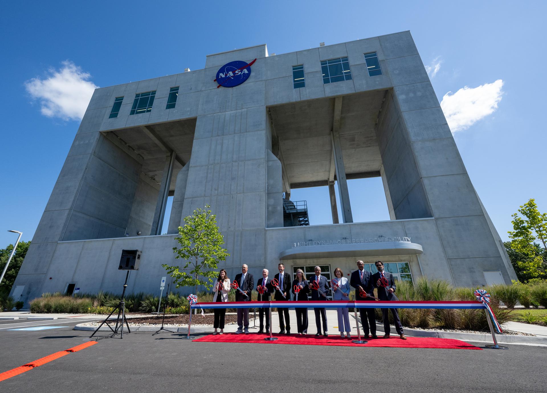
NASA opened its newest wind tunnel, the Flight Dynamics Research Facility, Friday, providing a critical resource for the agency and its partners to test the safety and performance of future generations of aircraft, rockets, and space exploration vehicles.
Located at NASA’s Langley Research Center in Hampton, Virginia, the Flight Dynamics Research Facility will support advances in aircraft safety, X‑plane development, drone research, and spacecraft technology. The facility will enable both free‑flight and mounted testing of a wide range of scale-model vehicles designed to travel through an atmosphere, from airplanes to space capsules returning to Earth.
“The Flight Dynamics Research Facility is NASA’s first major new wind tunnel in more than 40 years and gives us a powerful new platform to test the ideas and technologies that will shape the future of aviation and exploration,” said NASA Administrator Jared Isaacman. “America has led in air and space because we were willing to take on hard problems, challenge assumptions, and build what didn’t exist before. This facility gives the talented team at Langley, and our partners across government, industry, and universities, the tools to keep pushing the boundaries of what’s possible and ensure America remains the world leader in air and space.”
A ribbon-cutting ceremony at NASA Langley marked the start of a new chapter in flight research. Agency leaders, partners, and Virginia officials emphasized how the Flight Dynamics Research Facility’s state-of-the-art capabilities will shape the future of flight and exploration.
“The opening of the Flight Dynamics Research Facility represents a significant advancement for NASA and for the nation,” said Dr. Trina Dyal, NASA Langley center director. “By bringing modernized testing capabilities under one roof, we are enabling transformative research that will ensure the United States remains at the forefront of aeronautics and exploration.”
Built through a partnership with the U.S. General Services Administration (GSA), the facility replaces aging infrastructure with an energy-efficient facility that reduces maintenance costs and provides the flexibility needed for future research. The Flight Dynamics Research Facility is part of a broader, long-term collaboration between the agencies, representing the fourth new building GSA has delivered to NASA under Langley’s 20-year campus revitalization plan.
“GSA is proud to partner with NASA in delivering the Flight Dynamics Research Facility, a state-of-the-art asset that will power the next generation of American dominance in aeronautics and space exploration,” said Edward C. Forst, GSA administrator. “This facility reflects what we do best: provide the advanced, expertly designed installations that federal agencies need to carry out their missions. With these new capabilities, NASA will be better equipped to test bold ideas, validate new designs, and advance technologies that will serve the nation for decades to come.”
The Flight Dynamics Research Facility combines and improves upon the capabilities of two historic NASA Langley wind tunnels – the 20-Foot Vertical Spin Tunnel and the 12-Foot Low-Speed Tunnel. The 25,000-square-foot building features a vertical wind tunnel with improved airflow, modern digital systems, and flexible testing capabilities that will allow researchers to study how aircraft, spacecraft, parachutes, and other vehicles behave during flight.
The facility’s 20-foot diameter test chamber is much larger than those of its NASA Langley predecessors, allowing for more air to pass around test models and improving data accuracy. Its increased size also allows for the use of larger, more detailed models during testing.
The Flight Dynamics Research Facility’s top airspeed of 117 miles per hour is twice as fast as the old facilities, enabling free-flight tests of heavier scale models. This will allow simulations of full-scale vehicles flying at higher altitudes – a critical capability for operations such as studying the stability of aircraft or reentry capsules coming back from space.
The facility’s wind power comes from four 750-horsepower motors, each with an integrated, 14-foot diameter, eight-bladed fan. The fan blades are made of lightweight carbon fiber, enabling rapid, precise airspeed adjustments during free‑flight tests.
The Flight Dynamics Research Facility illustrates the powerful synergy between NASA’s aeronautics and space exploration efforts, with each driving innovation in the other. The facility will drive experimental research across a wide range of flight systems, advancing the development of autonomous flight vehicles, drones, commercial and military aircraft, and X‑planes.
As NASA prepares for a sustained human presence on the lunar surface through the Artemis program and the development of a Moon Base, the facility will play a key role in testing vehicle designs for entry, descent, and landing that will help reduce mission risk and support the safe return of crews to Earth. NASA also will be able to use the wind tunnel to help design aircraft for Mars and other destinations in our solar system where atmospheric flight is possible.
With the Flight Dynamics Research Facility now open, NASA is entering a new era in flight research – one that will shape the aircraft and spacecraft of tomorrow, strengthen industry partnerships, and extend the agency’s legacy of pioneering aerospace leadership.
The facility is managed under the Aerosciences Evaluation and Test Capabilities portfolio in the Aeronautics Division of NASA’s Research and Technology Mission Directorate.
Learn more about the Flight Dynamics Research Facility at:
-end-
Camille Gallo / Rob Margetta
Headquarters, Washington
202-358-1600
camille.m.gallo@nasa.gov / robert.j.margetta@nasa.gov
Kimiko Booker / Brittny McGraw
NASA Langley, Hampton, Virginia
757-506-5939 / 757-769-3763
kimiko.s.booker@nasa.gov / brittny.v.mcgraw@nasa.gov
Curiosity Blog, Sols 4961-4967: Approaching a Break in the Rock Record?
2026-07-31 14:41
3 min read
Curiosity Blog, Sols 4961-4967: Approaching a Break in the Rock Record?

Written by Abigail Fraeman, Deputy Project Scientist, Jet Propulsion Laboratory, California Institute of Technology
Earth planning date: Friday, July 24, 2026
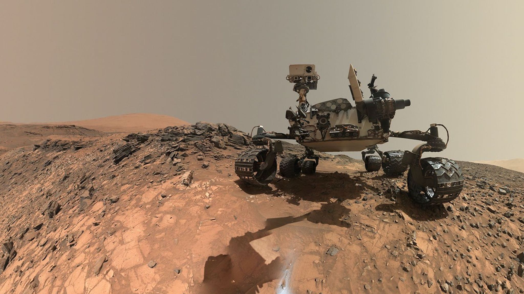
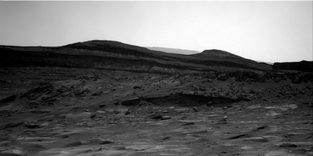
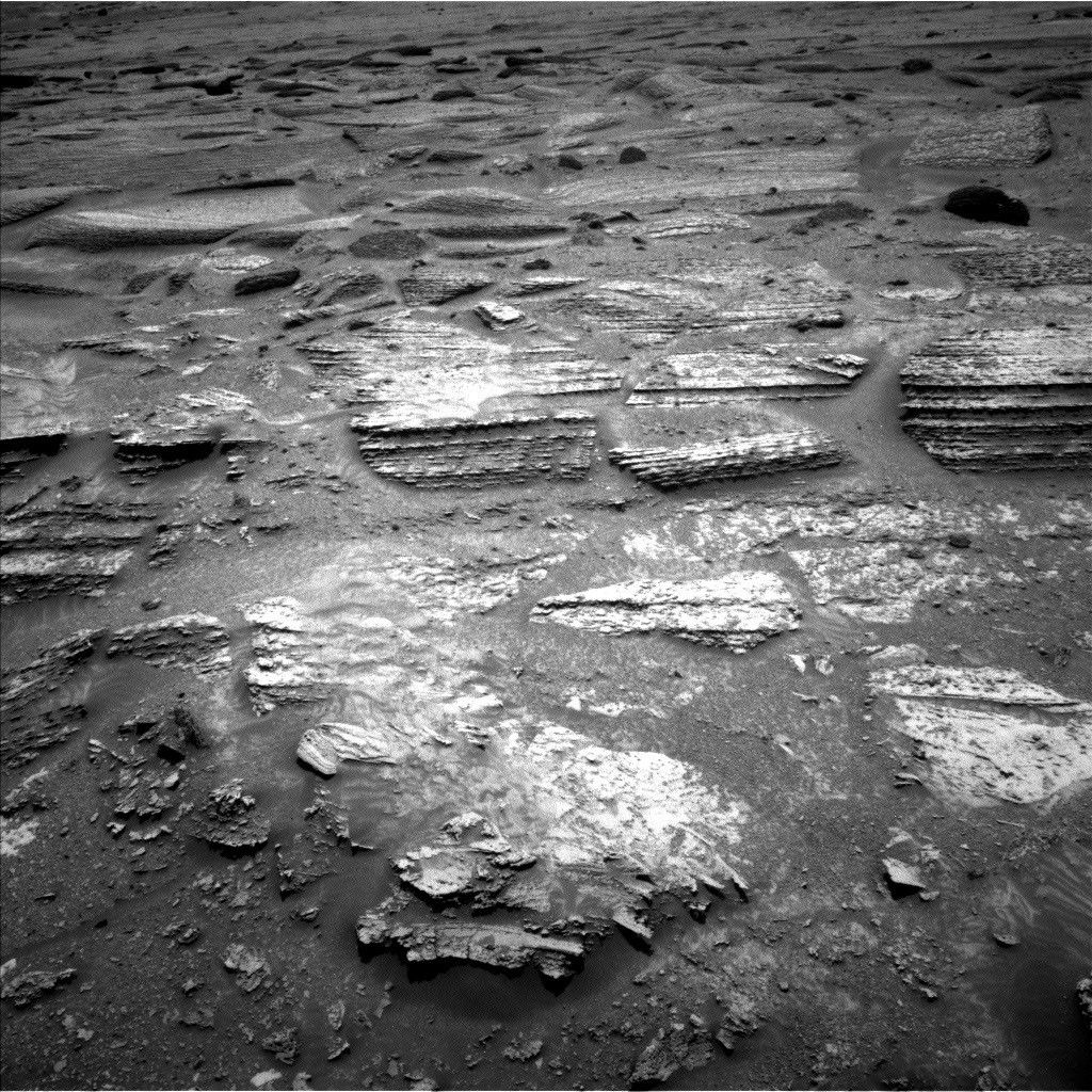
Curiosity spent the week continuing to climb her way up through the layers of Mount Sharp, exploring the sedimentary rock strip chart of Martian history. The rover has reached a layer where the science team had spotted a possible “erosional supersurface” by analyzing orbital data alongside images of the layers in the buttes above us. “Erosional supersurface” is a geologic term that describes places where layers of sediment have been stripped away by wind or water at a regional scale before newer layers are deposited atop them. These surfaces are common in wind-blown sand (aeolian) deposits, and they mark a break in the rock record. After eyeing this unusual section of Mount Sharp for the last few months, it’s exciting to finally be so close to this feature. Curiosity’s science instruments will give us the geologist’s-eye view of this region that we need to really understand this feature, including its composition and centimeter-scale geometry.
Our two plans this week focused on imaging the possible supersurface from a few different locations. This past weekend we backed away from the feature to get a good rover’s-eye view of the feature, which set us up nicely on Monday to collect two massive Mastcam mosaics across the entire layer. ChemCam provided additional support by collecting some long-distance RMI images of the most interesting areas of the supersurface. We also took the time to measure the composition of rocks at the bottom of this surface with a MAHLI and APXS target named “Monte Darwin” and ChemCam LIBS targets named “Patacamaya,” “Tarucachi,” and “Mojoncasa.”
Monday’s drive took us closer to the supersurface, while taking some MAHLI and Mastcam images of our wheels along the way, and the drive we planned today will bring us right up to the base of the layer. The science team was able to use Monday’s image to pick the most scientifically interesting spot to cross this surface, while also juggling constraints made by the reality of where we can drive our rather large rover — there’s some pretty sandy and steeply sloping terrain around here, so we also found a spot that looks like it’ll be one of the easier areas to traverse. Hopefully next week we’ll go up and over the supersurface — stay tuned.
Share
Details
Related Terms
Explore More


NASA’s Roman Telescope to Carry 1.35 Million Names to Deep Space
2026-07-31 14:11
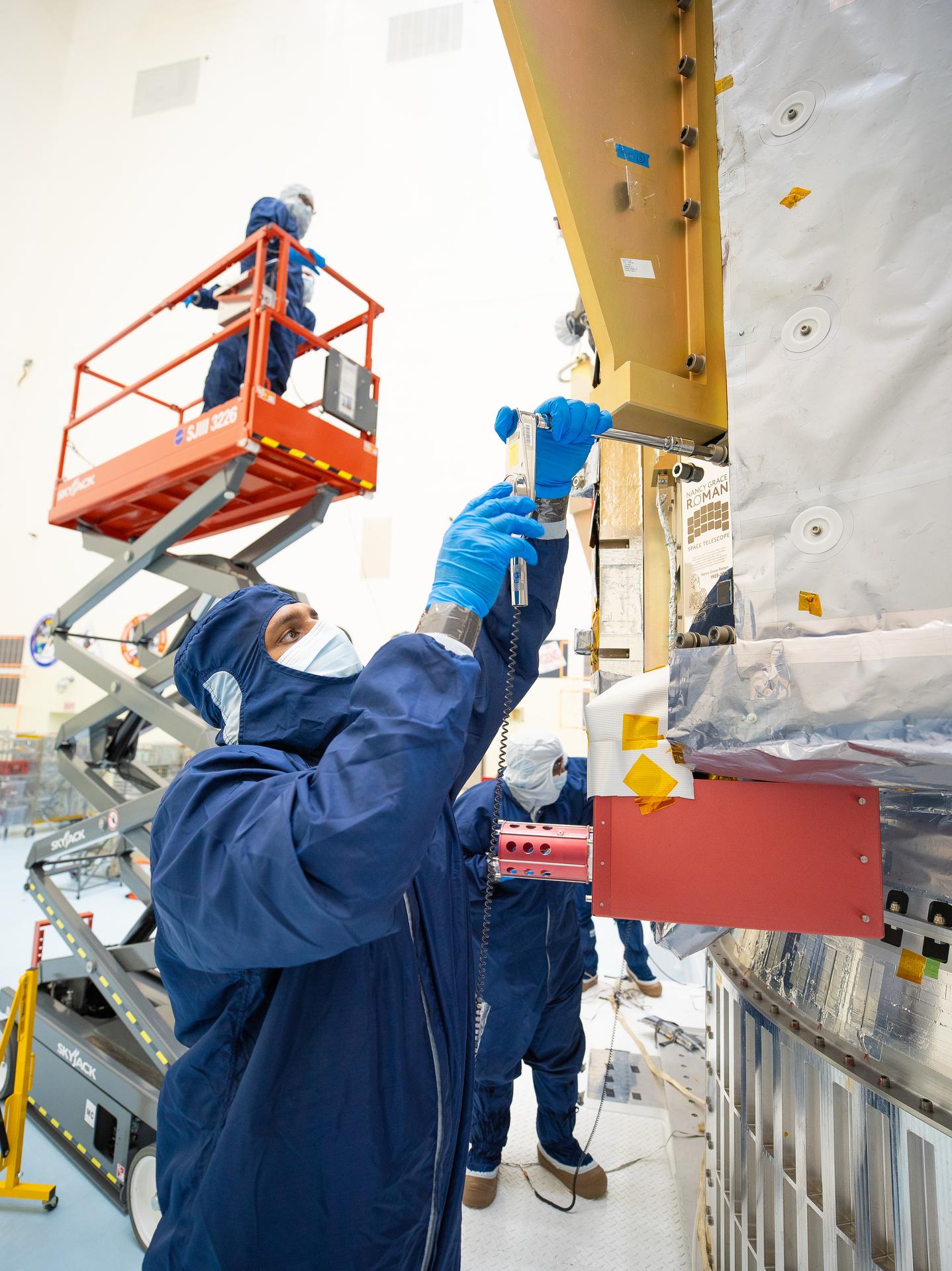
On July 27, technicians at NASA’s Kennedy Space Center in Florida installed a memory card containing 1,350,144 names as part of a commemorative plaque on the Nancy Grace Roman Space Telescope. The names were submitted by people globally, including astronauts from Artemis II and Artemis III. The memory card will travel with the Roman observatory to the Sun-Earth Lagrange point 2, or L2, about one million miles from Earth, where the Sun’s and Earth’s gravity balance out.
Roman is named after Dr. Nancy Grace Roman, NASA’s first chief astronomer and one of the architects of the agency’s modern science program. Roman championed space-based observatories that could study the universe from above Earth’s hazy atmosphere while making their data broadly available to the scientific community.
NASA and SpaceX are targeting launch for no earlier than 7:26 a.m. EDT Sunday, Aug. 30 aboard a SpaceX Falcon Heavy from Launch Complex 39A at Kennedy.
To learn more about the Roman mission, visit:
Image credit: NASA/Jolearra Tshiteya
APOD: 2026 July 31 – NGC 4372 and the Dark Doodad
2026-07-31 04:05
APOD
Astronomy Picture of the Day
Discover the cosmos! Each day a different image or photograph of our fascinating universe is featured, along with a brief explanation written by a professional astronomer.

NGC 4372 and the Dark Doodad
Explanation: The Dark Doodad Nebula drifts through southern skies, a tantalizing target for binoculars toward the small constellation Musca, The Fly. A dusty interstellar cloud, it’s seen against rich starfields just south of the Coalsack Nebula and the Southern Cross. Stretching for about 3 degrees across this telescopic field of view, the Dark Doodad is punctuated near its southern tip (upper right) by yellowish globular star cluster NGC 4372. Of course NGC 4372 roams the halo of our Milky Way galaxy, a background object some 20,000 light-years away and only by chance along our line-of-sight to the Dark Doodad. About 700 light-years distant and over 30 light-years long, the Dark Doodad’s well defined silhouette belongs to the potentially star-forming Musca molecular cloud. The dusty Dark Doodad’s delightfully alliterative moniker was first coined by astro-imager and writer Dennis di Cicco in 1986 while observing Comet Halley from the Australian outback.
Tomorrow’s picture: buck and belt
| Date | July 31, 2026 |
|---|---|
| Credit | Image Credit and Copyright: Alessandro Cipolat Bares |
| Authors & editors: | Robert Nemiroff, Jerry Bonnell, Cecilia Chirenti, Keighley Rockcliffe |
| A service of: |
ASD at NASA / GSFC, NASA Science Activation & Michigan Tech. U. |
Destructive Fires Char Western Europe
2026-07-31 04:01
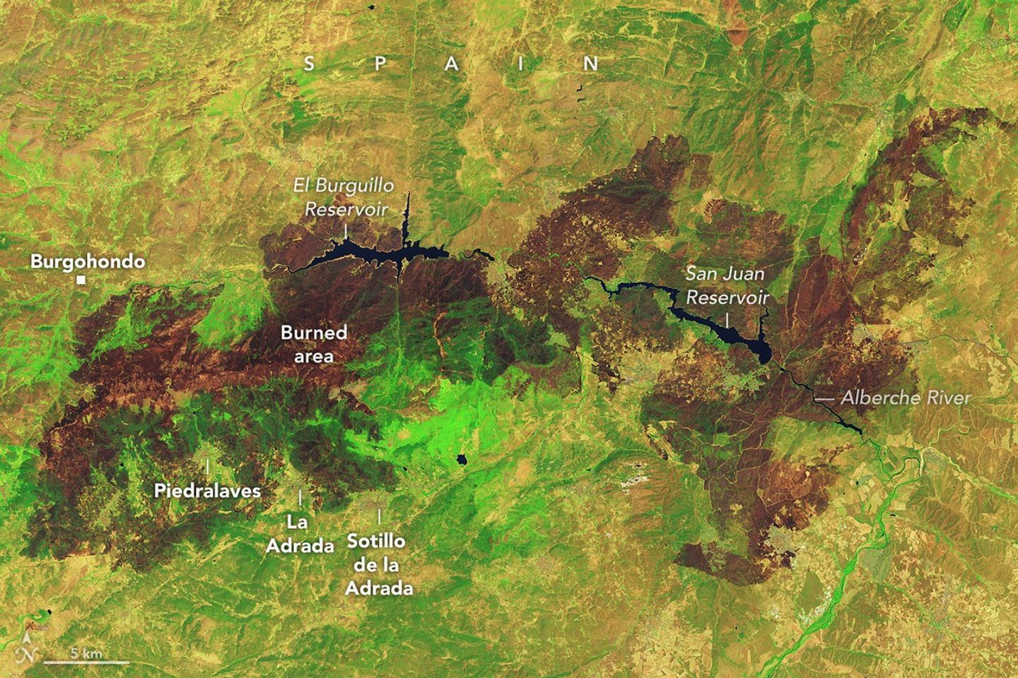
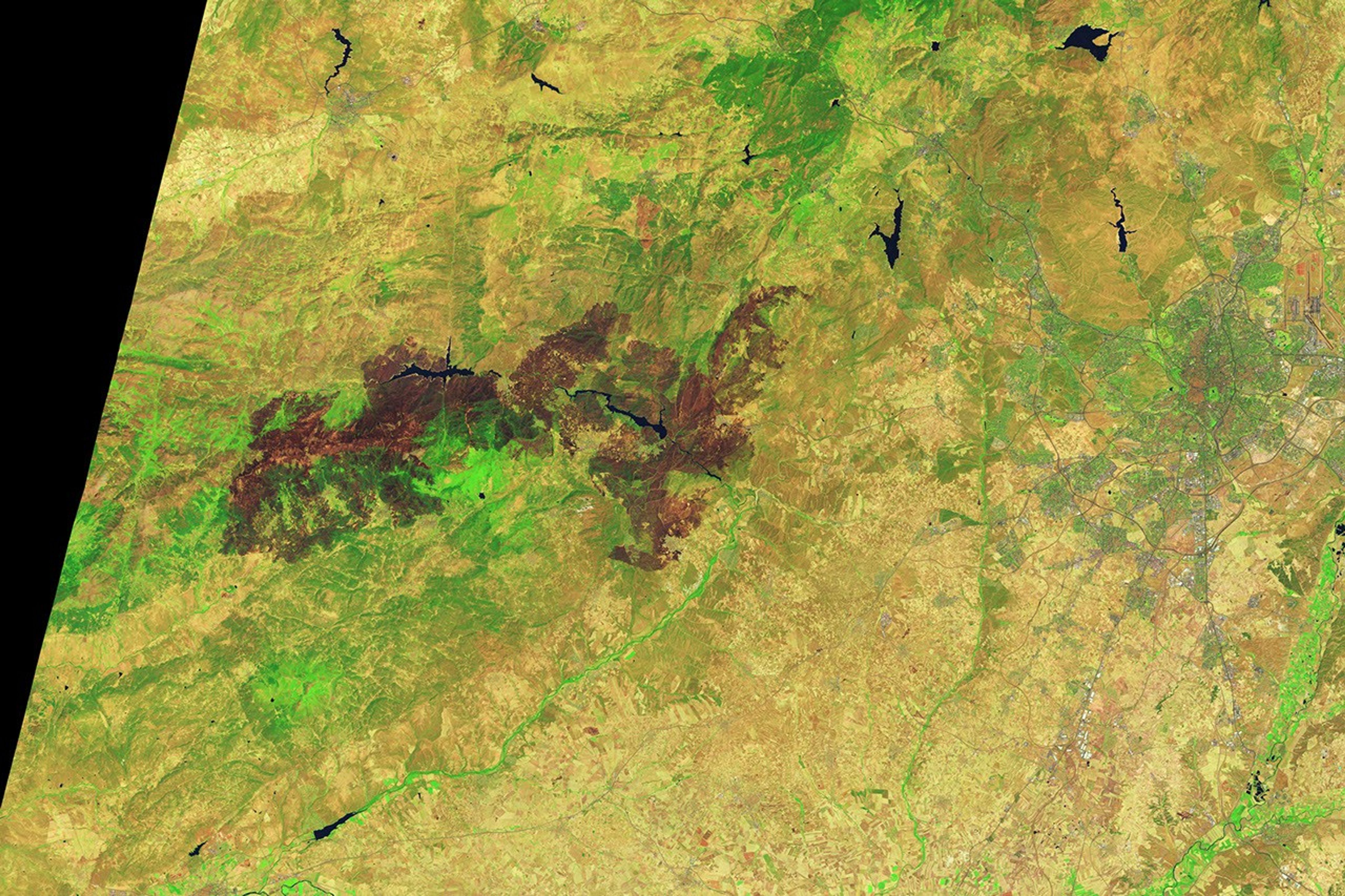
Wildland fires occur across Europe every summer, but those that erupted in Spain and France in July 2026 were among the largest and most disruptive the two countries have faced in decades. Some of the most consequential fires emerged in southwestern France’s Gironde Department and Spain’s Ávila and Madrid provinces in mid-July, where blazes forced hundreds of thousands of people to evacuate and destroyed hundreds of homes.
Government officials in Spain say that a fire in Ávila, after charring around 50,000 hectares (124,000 acres), is the largest on record, surpassing a blaze that burned in Larouco, Quiroga, and Oencia in 2025. NASA satellites first observed signs of the Ávila fire burning near Burgohondo on July 22 and July 23. By July 24, it had merged with fires in neighboring provinces, pushing the total area burned to 77,000 hectares, an area about the size of New York City.
The image above, captured by Landsat 9, shows charred landscapes around Burgohondo on July 29, 2026. In the false-color image, unburned vegetation appears light green, and burned areas appear brown. The two reservoirs in the center of the image were heavily affected. Flames tore through homes, restaurants, campgrounds, marinas, and other infrastructure surrounding the reservoirs, according to news reports.
A similar crisis unfolded in southwestern France, west of Bordeaux. One of the largest fires to burn in France this decade charred more than 42,000 hectares, prompting large-scale evacuations and devastating the village of Le Porge. As of late July, fires had burned more than 90,000 hectares across France, more than any other season in decades, according to data from the European Forest Fire Information System.
Environmental conditions months before the fires ignited made the landscape in both Spain and France particularly susceptible to burning, according to an analysis conducted by researchers with The State of Wildfires Project. Unusually wet winter weather enhanced vegetation growth in grasslands, shrublands, and forest understories, and then a series of sweltering heat waves and a period of drought parched the vegetation and primed it to burn. Several days of strong winds reaching 65 kilometers (40 miles) per hour at times served as the final trigger, the researchers found, fanning flames and encouraging rapid spread.
On July 25, conditions at fires in southwestern France grew so intense that French firefighters reported the formation of a pyrocumulonimbus—a towering type of “fire cloud” that draws convective energy from the heat of the fires. An international group of atmospheric scientists and fire experts who track the unusual clouds has documented the occasional formation of the clouds in Spain and Portugal in recent decades, but members of the group note that this is the first report of a fire in France producing one.
Thousands of firefighters and military personnel have battled fires in both countries. Crews have used aircraft to attack the fires with water and flame retardant, while teams on the ground have constructed firebreaks using tools ranging from bulldozers to hand tools. Firefighters gained the advantage by late July, allowing authorities to start lifting evacuation orders. However, forecasters are warning that the risk of fire in the coming days remains high due to the persistence of hot, dry conditions.
Government satellite data are part of a global system of observations used to track fire behavior and analyze emerging trends. Among the real-time wildfire monitoring tools that NASA makes available are FIRMS (Fire Information for Resource Management System) and the Worldview browser.
NASA Earth Observatory image by Lauren Dauphin, using Landsat data from the U.S. Geological Survey. Story by Adam Voiland.
References & Resources
- AP (2026, July 30) As France tames wildfire and lets 84,000 evacuees go home, blazes flare across Europe. Accessed July 30, 2026.
- The Conversation (2026, July 29) ‘The fire has such power’: why the wildfires gripping France and Spain are off the charts. Accessed July 30, 2026.
- Drought.gov (2026, July 22) International. Accessed July 30, 2026.
- EFE (2026, July 25) France Wildfires: Record evacuations as fires near Bordeaux. Accessed July 30, 2026.
- EFE (2026, July 26) El incendio de Ávila ha quemado 50.000 hectáreas, el mayor fuego de la historia de España. Accessed July 30, 2026.
- European Commission (2026, July 30) Current wildfire situation in Europe. Accessed July 30, 2026.
- European Commission (2026, July 30) Current drought situation in Europe. Accessed July 30, 2026.
- France24 (2026, July 26) French firefighters face ‘pyrocumulonimbus’ for first time. Accessed July 30, 2026.
- NASA Earthdata, Wildfires. Accessed July 30, 2026.
- The New York Times (2026, July 28) The Fires in France and Spain Are Breaking Modern Records. Accessed July 30, 2026.
- Peterson, D., et al. (2025) Worldwide inventory reveals the frequency and variability of pyrocumulonimbus and stratospheric smoke plumes during 2013–2023. Climate and Atmospheric Science, 8, 325.
- Reuters (2026, July 27) Mapping the wildfires outside Bordeaux and Madrid. Accessed July 30, 2026.
- RTVE (2026, July 27) Anatomía del incendio más grande de la historia de España: más de 50.000 hectáreas en cinco días. Accessed July 30, 2026.
- State of Wildfires Project (2026, July) Understanding Spain’s 2026 Wildfires through hydroclimatic rebound. Accessed July 30, 2026.
- Time (2026, July 28) Photos Show the Destruction in France and Spain From Ferocious European Wildfires.Accessed July 30, 2026.
You may also be interested in:
Stay up-to-date with the latest content from NASA as we explore the universe and discover more about our home planet.

Firefighters are battling two destructive blazes in the southern part of the state as drought grips the U.S. Southeast.
Dry, warm, and windy conditions across the U.S. Great Plains led to extreme fire activity in March 2026.

The blaze burned more than 150 square miles and swept through parts of a ski resort.




TechCrunch - Latest
Sam Altman isn’t the only one who wants to pump the brakes on AI
2026-07-31 17:26
Snapchat no longer rewards fully AI-generated Spotlight content
2026-07-31 16:49
Siri AI could come with a paywall for power users
2026-07-31 16:08
GM and Ford are talking less and less about EVs
2026-07-31 15:47
Samsung expects memory shortage to worsen through 2027 and last until 2028
2026-07-31 15:37


