📰 Trending Topics
Google News - Trending
Google News - Technology
Apple's iPhone Duo is getting roasted over screen cracks - Business Insider
2026-10-27 22:56
- Apple's iPhone Duo is getting roasted over screen cracks Business Insider
- Apple responds to user reports of broken iPhone Duo screens on new foldable phone CNBC
- Apple’s Foldable iPhone Duo Draws Early Complaints of the Screen Cracking Bloomberg.com
- Here’s why the iPhone Duo’s hinge could be cracking the screen The Verge
- Apple hit by ‘Crackgate’ outcry over iPhone Duo screen problems Financial Times
Apple refreshes the iMac, entry-level MacBook Pro with the M6 chip - Ars Technica
2026-10-27 22:37
- Apple refreshes the iMac, entry-level MacBook Pro with the M6 chip Ars Technica
- Apple Bets MacBook Pro Buyers Will Pay More for Touch Screens Bloomberg
- Apple Unveils New MacBook Pro Ahead Of November Launch — HSBC Sees Strong iPhone Demand, Potential AI-Driven Upgrade Cycle Yahoo Finance
- Apple introduces the new 14-inch MacBook Pro with M6 Apple
- We’ve had touchscreen laptops for years. Can Apple make them better? The Verge
Vivo's X500 Pro Max Is Another Camera-Focused Smartphone With More Video Tricks - Engadget
2026-10-27 15:30
- Vivo's X500 Pro Max Is Another Camera-Focused Smartphone With More Video Tricks Engadget
- Vivo X500 Pro Max review: holy camera! PhoneArena
- Vivo’s X500 series launches globally with MediaTek chips and insane cameras 9to5Google
- vivo x Kolder Creative: New Smartphone Filmmaking Masterclass Featuring vivo X500 Pro Max Press Release Hub
- vivo X500 Pro Max review GSMArena.com
4 Powerful Android Tablets To Buy Instead Of The New OLED iPad Mini - BGR
2026-10-27 20:17
- 4 Powerful Android Tablets To Buy Instead Of The New OLED iPad Mini BGR
- Apple Debuts $699 Water-Resistant iPad Mini With OLED Screen Bloomberg.com
- Apple gives iPad mini its biggest update ever Apple
- Apple updates the iPad Mini with a larger OLED display The Verge
- Everything Apple Announced This Week So Far: New iPad And MacBooks Engadget
Exclusive: Meta director Rohit Patel departs after 8 years to take on Microsoft Office Suite - TechCrunch
2026-10-27 14:59
- Exclusive: Meta director Rohit Patel departs after 8 years to take on Microsoft Office Suite TechCrunch
- Ex Meta AI Director Leaves Big Tech to Build a Microsoft Office Killer Android Headlines
- Meta AI Director Rohit Patel steps down to launch AI office suite ndoc.ai Adgully
- Ex-Meta AI director launches Ndoc, an AI-native... Pluang
- Indian American ex-Meta AI director Rohit Patel launches startup to challenge Microsoft, Google The American Bazaar
NASA - Breaking News
Curiosity Blog, Sols 5043-5049: Preparing to Drill at ‘Nazca’
2026-10-28 05:39
4 min read
Curiosity Blog, Sols 5043-5049: Preparing to Drill at ‘Nazca’
Written by Lucy Lim, Planetary Scientist at NASA’s Goddard Space Flight Center
Earth planning date: Friday, Oct. 16, 2026
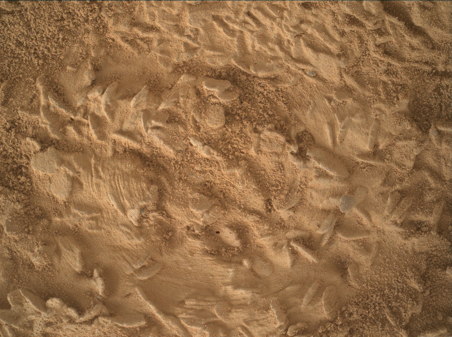
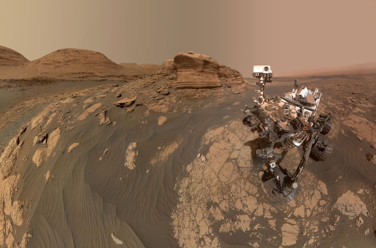
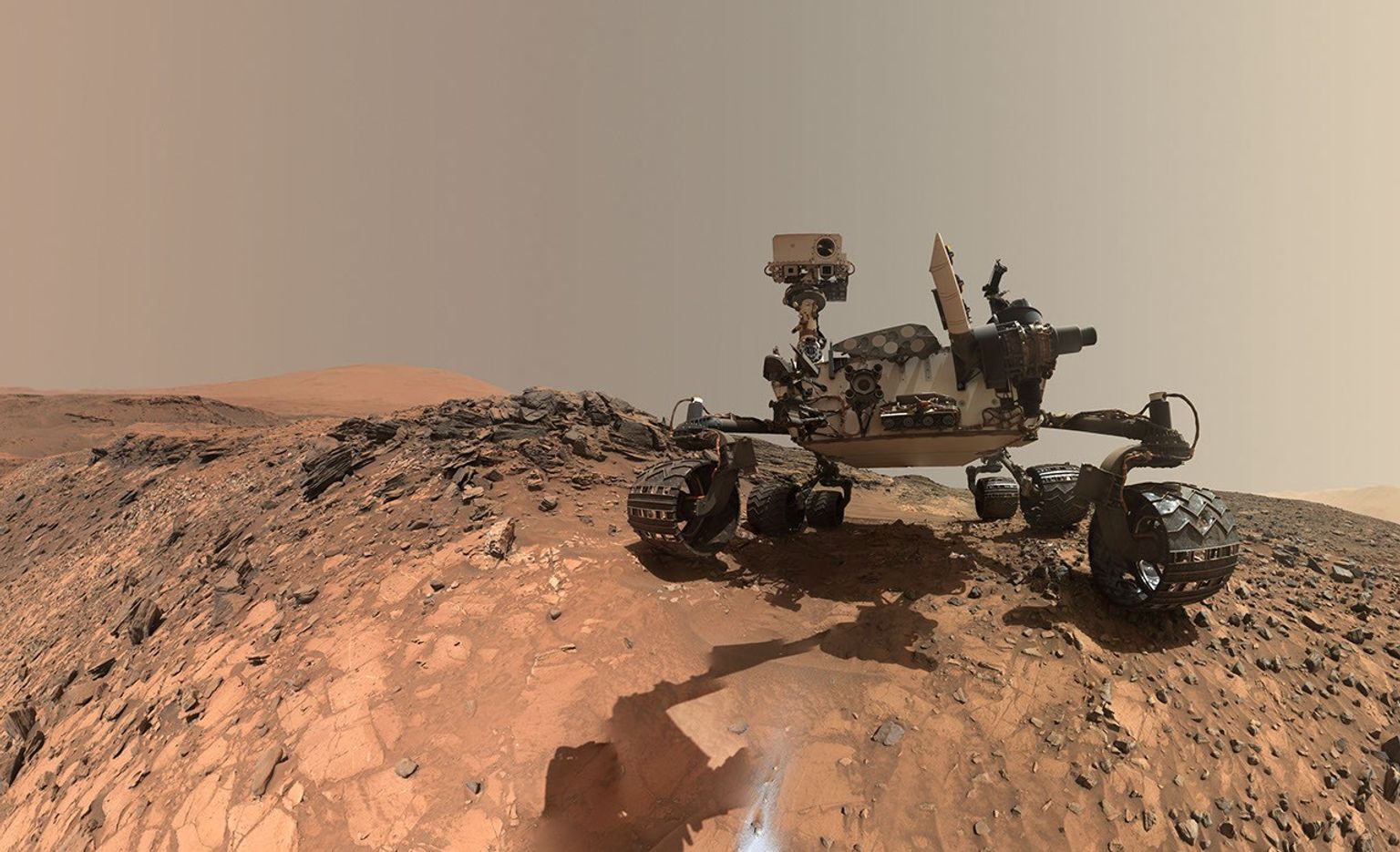
Following the Basque Lakes drill campaign, Curiosity has returned to a spot just a few meters away from the “Chiu Chiu” block to conduct our next drill campaign. “Chiu Chiu” itself wasn’t a good candidate for drilling but the block just beyond it was much more promising, so it became our drive target during Monday’s planning. I was on planning Friday as Geology and Mineralogy Science Theme Lead when we received our close-up views of the neighbor block from the post-drive imaging and our team was happy to see that it was jam-packed with the “disc- and needle-” shaped lumps, just like “Chiu Chiu.” We quickly gave the science go-ahead to proceed with preparations for drilling at the newly named “Nazca” site.
One major hypothesis about how the “discs and needles” texture formed is that the characteristic shapes were originally created during the growth of crystals, or “crystal forms.” Minerals will tend to grow into specific shapes depending on their microscopic crystal structure, similar to the salt crystals that you can grow in your kitchen as a home science project. (Maybe you have grown one of those for a science class in school!) The relatively large sizes of the crystal forms at “Nazca” and “Chiu Chiu” are providing clues about the temperature at the time when they grew and the availability of salts and fluids. However, we can’t necessarily assume that the modern-day composition represents the original mineral because sometimes mineral crystals are replaced by other minerals some time after original crystallization. The new minerals are then known as “pseudomorphs” because they have the same shape as the first minerals but not the same composition or molecular structure.
As we prepared for the drill preload test, we also planned several special observations aimed at highly detailed characterization of the crystal forms. MAHLI will execute a Quantitative Relief Model (“QRM”) observation consisting of five overlapping images at slightly different geometries. The combination of these will enable a detailed three-dimensional relief model to be constructed. In addition, MAHLI will also add extra frames to its highest-resolution imaging by doubling the number of focus mechanism steps. Together, these observations will increase the resolution of the 3D models we will have of the crystal forms.
Meanwhile, the ChemCam LIBS will conduct a “depth profile” experiment to obtain compositional information from slightly deeper layers within a nearby crystal-form-rich target, “Toucan”. Normally the 150 LIBS laser shots from each sol’s observation are spaced out over a five-point raster at 30 shots per point, but this time we are concentrating all 150 laser shots on the same spot on the rock. Since each laser shot vaporizes a very small amount of the rock to form a plasma, the 150-shot profile should penetrate approximately five times deeper than a normal 30-shot point observation. We will thus be able to observe the composition deeper inside the exposed crystal form and see whether it’s different from the surface-level composition. There are several reasons this could be the case including exposure of the surface to the modern Martian environment and also the circumstances in which the crystal form developed originally, so it’s an experiment worth pursuing.
The LIBS, DRT and APXS will also be applied to the “Nazca” spot before the preload test to characterize its surface composition as thoroughly as possible before drilling. The third LIBS of the plan will go to “Condor,” a nearby block in which a finely layered texture is exposed.
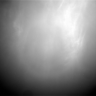
We also continued to observe the modern Martian environment as twilight cloud season begins. In this plan we included some nighttime imaging of the larger and brighter of Mars’ two satellites, Phobos. Capturing images of Phobos and the nearby sky when Phobos is full can show sunlight reflecting off the moon and scattering in the Martian atmosphere, providing a good way to estimate the particle sizes in the Martian clouds. We can do similar measurements sometimes with solar observations, but the Phobos data allow us to measure cloud particle sizes later in the night. We expect to be measuring high-altitude carbon dioxide (CO2) clouds in this observation.
Share
Details
Related Terms
Explore More

APOD: 2026 October 28 – The Mutual Occultation of Ganymede and Io
2026-10-28 04:05
APOD
Astronomy Picture of the Day
Discover the cosmos! Each day a different image or photograph of our fascinating universe is featured, along with a brief explanation written by a professional astronomer.
The Mutual Occultation of Ganymede and Io
Explanation: Jupiter is one of the least lonely planets in the Solar System, at least when it comes to natural satellites. 115 moons have been discovered orbiting Jupiter so far! (Saturn has the most with 293, but who’s counting.) Ganymede and Io, two of Jupiter’s Galilean moons, met in the sky on October 20th, 2026. Today’s video captures the meeting, with Ganymede briefly blocking Io from view. This event, when an astronomical object passes in front of another and either completely or partially blocks it, is called a mutual occultation. The mutual occultations of Galilean moons are rare to witness because they require Earth’s edge-on view of their orbits. This occurs once every 6 years when Jupiter reaches its equinox and appears less “tilted”. Ganymede is also casting its shadow on Jupiter’s right side. Any fictional Jovian species within the shadow would experience a solar eclipse!
Tomorrow’s picture: a planet grows horns
| Date: | October 28, 2026 |
|---|---|
| Credit & Copyright: | Michael Wong |
| Authors & editors: | Keighley Rockcliffe, Robert Nemiroff, Jerry Bonnell, Cecilia Chirenti |
| A service of: |
ASD at NASA / GSFC, NASA Science Activation & Michigan Tech. U. |
The Land of the Standing-Up Rocks
2026-10-28 04:01
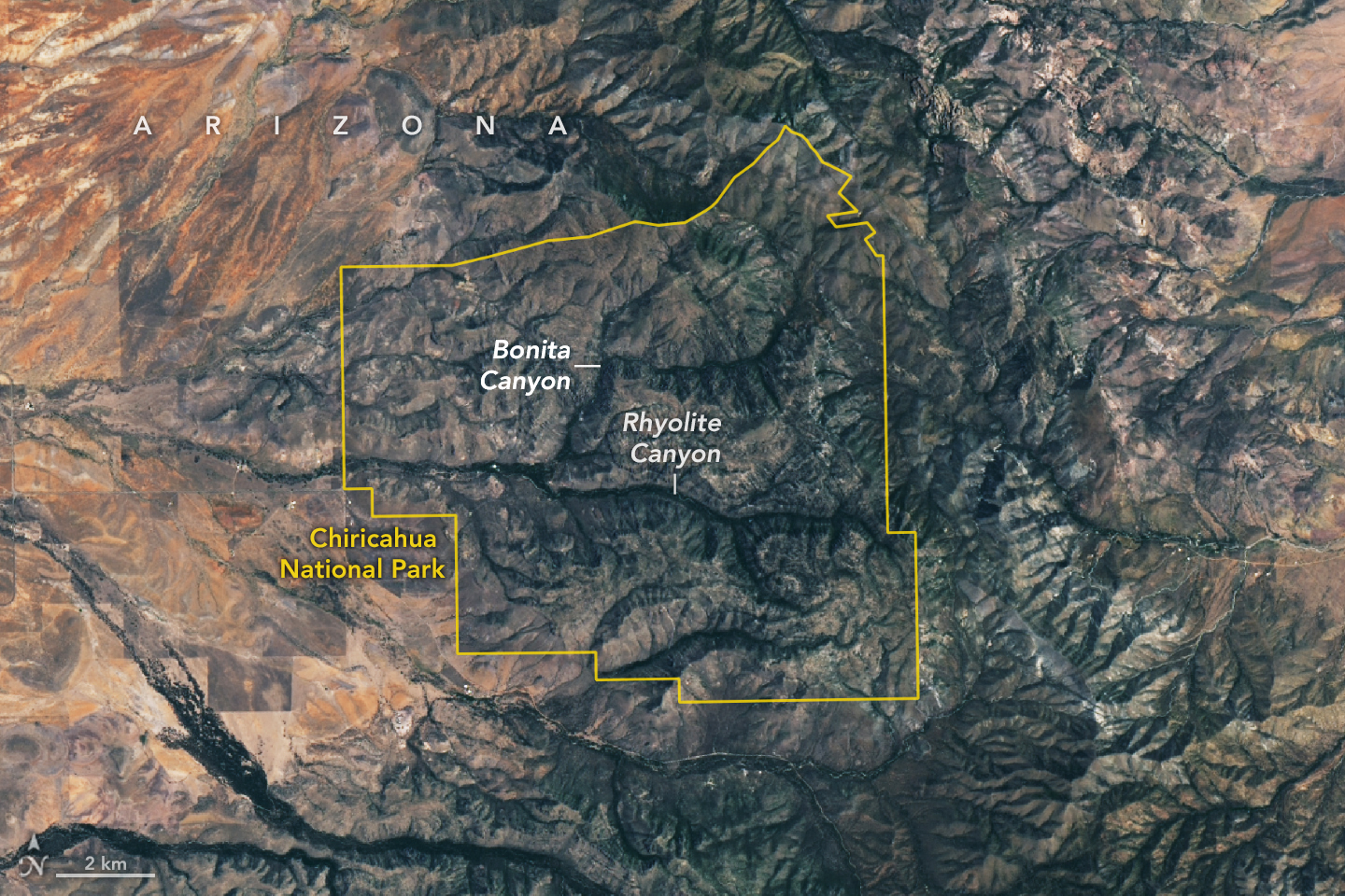
Some 27 million years ago, a volcano in what’s now southeastern Arizona unleashed a spectacular series of eruptions, strewing more than 1,000 times as much volcanic material across the landscape as Mount St. Helens did in 1980.
The explosive eruptions blanketed the region, part of the Chiricahua Apache Nation’s traditional lands, with ash and pumice. Layered into this were massive pyroclastic flows that hardened into deposits of welded rhyolitic tuff that in some areas were nearly 1,600 feet (500 meters) thick, about three times the height of the Washington Monument. As the magma chamber emptied, the ground above it collapsed, leaving a gaping depression—the Turkey Creek caldera—that was roughly 12 miles (19 kilometers) wide and 4,900 feet (1,500 meters) deep.
An array of geologic processes, including erosion and weathering, gradually sculpted the welded layer of tuff into the collection of dramatic spires, hoodoos, and canyons that visitors to the caldera area encounter today.
The Apache called the area “The Land of the Standing-Up Rocks” for good reason. Hiking through Rhyolite Canyon or driving through Bonita Canyon means encountering a dizzying maze of rock pinnacles, some hundreds of feet tall. Others, like Big Balanced Rock, have surprisingly large boulders precariously perched on top. Meanwhile, those at Heart of Rocks and Massai Point are gathered into groups of hundreds.
The area was designated a national monument in 1924 to preserve its remarkable geology. In October 2026, it was redesignated as Chiricahua National Park (pronounced cheery-cow-ah). The OLI (Operational Land Imager) on Landsat 9 captured this cloud-free image of the new national park on July 2, 2026.
Individual rock spires are too small to distinguish, but the eroding rhyolitic tuff landscape appears gray. Stream valleys dense with trees and other vegetation, including Rhyolite Canyon and Bonita Canyon, snake across the landscape. With four biogeographic regions converging in the park—the Sonoran Desert, the Chihuahuan Desert, the Rocky Mountains, and the Sierra Madre—it is a haven of plant diversity.
Among the 1,000 species growing within the park’s varied desert, grassland, chaparral, deciduous forest, and coniferous forest ecosystems are agaves, prickly pear cacti, yuccas, manzanita, pine, fir, cypress, sycamore, juniper, and oak. The park’s location within the Chiricahua Mountains puts it among several “sky islands” in Arizona—isolated mountain ranges that emerge from the surrounding desert “sea.” According to the National Park Service, the range’s highest point (outside the park) rises 2,986 meters (9,795 feet) above sea level, more than 1,800 meters above the surrounding valley.
NASA Earth Observatory image by Lauren Dauphin, using Landsat data from the U.S. Geological Survey. Story by Adam Voiland.

References & Resources
- The Conversation (2026, October 21) Chiricahua is the nation’s newest national park – what does that mean? Accessed October 27, 2026.
- National Geographic (2026, October 26) How Volcanoes Helped Forge America’s Newest National Park. Accessed October 27, 2026.
- National Park Service (2026) NPS Geodiversity Atlas—Chiricahua National Monument, Arizona. Accessed October 27, 2026.
- National Park Service (2026) Chiricahua National Park. Accessed October 27, 2026.
- National Park Service (2026) Geologic Formations. Accessed October 27, 2026.
- Smithsonian Magazine (2026, October 22) Arizona’s Otherworldly ‘Wonderland of Rocks’ Is Now America’s Newest National Park. Accessed October 27, 2026.
- U.S. Department of the Interior (2026, October 21) Chiricahua National Monument Becomes America’s Newest National Park. Accessed October 27, 2026.
You may also be interested in:
Stay up-to-date with the latest content from NASA as we explore the universe and discover more about our home planet.
The meandering Congaree River sustains towering forest ecosystems and fashions oxbow lakes as it shifts across its floodplain.
Sites relevant to the start of the American Revolutionary War are interspersed throughout the modern-day Boston metropolitan region.

The colonial communities of “America’s historic triangle” played defining roles in the road to American independence.




NASA Invites Media to Crew Completion of Yearlong Mars Simulation
2026-10-27 19:27
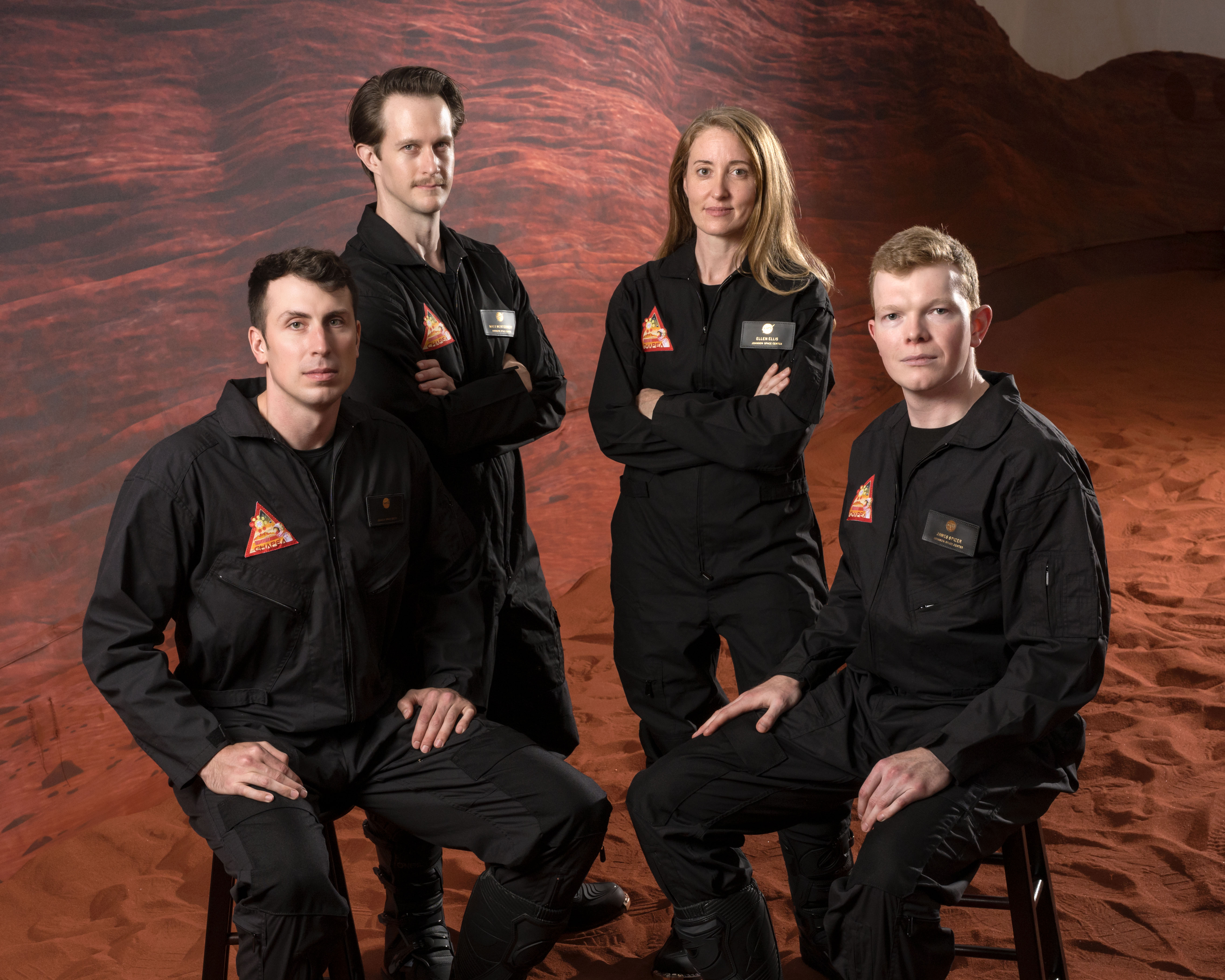
The four volunteers who lived and worked in a simulated NASA Mars mission for more than a year will exit their habitat on Saturday, Oct. 31, after 378 days of isolation in a facility at the agency’s Johnson Space Center in Houston. Health and performance data collected from the simulation can help NASA develop methods to counter human spaceflight risks for future Artemis and Moon Base missions.
Beginning at 3 p.m. EDT, NASA will provide live coverage of the volunteers’ departure from the Crew Health and Performance Exploration Analog (CHAPEA, pronounced cha-pea’-ah) mission habitat. The exit ceremony will be streamed on NASA Johnson’s YouTube and social accounts.
Johnson Center Director Vanessa Wyche and NASA astronaut Jack Hathaway will provide remarks. The CHAPEA crew members Ross Elder, Ellen Ellis, James Spicer, and Matthew Montgomery also will provide remarks.
Media are invited to watch the CHAPEA Mission 2 ceremony live at NASA Johnson on a screen outside the hangar holding the CHAPEA facility, after which a subject matter expert will be available in person to answer questions. Media will have the opportunity to capture the moment the crew exits the building, stepping outside for the first time in more than a year.
U.S. media interested in attending the activities in person, or media interested in speaking virtually with the CHAPEA Mission 2 crew members in the days following completion of their mission, must contact the NASA Johnson newsroom no later than 2 p.m., Friday, Oct. 30, at jsc-newsroom@mail.nasa.gov.
The second CHAPEA mission began on Oct. 19, 2025. Four crew members have lived and worked inside a 3D-printed 1,700-square-foot facility, simulating Mars mission operations, conducting simulated spacewalks, exercising, performing habitat maintenance, growing plants, and more, while operating under stressors that future deep space crews will likely experience. These included communication delays, resource limitations, and isolation.
Data from the mission can aid preparation for NASA’s lunar missions by optimizing food system design, efficient use of crew time, bandwidth on NASA’s Deep Space Network, and other aspects of living in deep space. In addition, data can help flight doctors and psychologists strengthen spaceflight medical care and behavioral support practices to ensure crew readiness and performance.
To learn more about NASA’s CHAPEA mission, visit:
https://www.nasa.gov/humans-in-space/chapea
-end-
Rachel Kraft
Headquarters, Washington
202-358-1600
rachel.h.kraft@nasa.gov
Kelsey Spivey
Johnson Space Center, Houston
281-483-5111
kelsey.m.spivey@nasa.gov
NASA’s Neo Surveyor Sunshade
2026-10-27 17:58
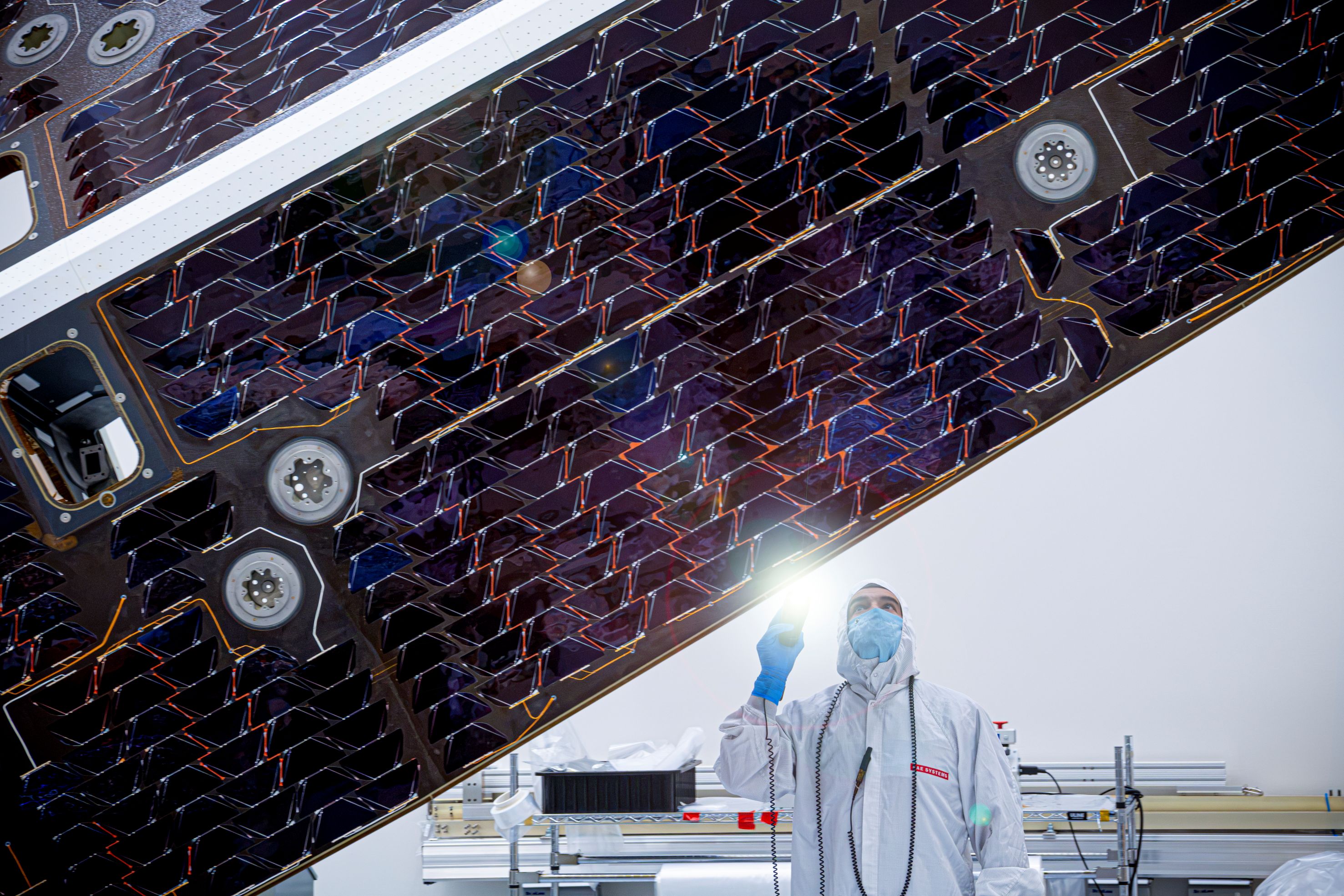
A technician inspects the large sunshade of NASA’s Near-Earth Object (NEO) Surveyor mission in this image released on Oct. 26, 2026. The sunshade structure, which stands 20 feet (6 meters) tall and measures 8 feet (2.4 meters) wide at its base, will keep the infrared space telescope cool as it searches for near-Earth asteroids and comets while also providing the spacecraft with power.
When in space, NEO Surveyor will detect some of the hardest-to-find asteroids and comets, some of which may be located in the direction of the Sun — a region of sky where ground-based optical telescopes have a harder time searching.
Read more about the sunshade and NEO Surveyor.
Image credit: BAE Systems Space & Mission Systems
TechCrunch - Latest
Jio shares surge 21% in market debut after blockbuster India IPO
2026-10-28 05:20
VCs will make billions on Anthropic’s IPO, but Amazon is set to make much (much) more
2026-10-28 01:15
Parents sue OpenAI, alleging GPT-4o coached their daughter off seizure medication
2026-10-27 23:34
The data center boom has an upside: innovation for the US grid
2026-10-27 22:55
Guidewire buys Hyperexponential for $1.7B in cash
2026-10-27 22:26